

2024.04.24
Report | and wander HIKING CLUB
in Yaeyamaand wander journal #74
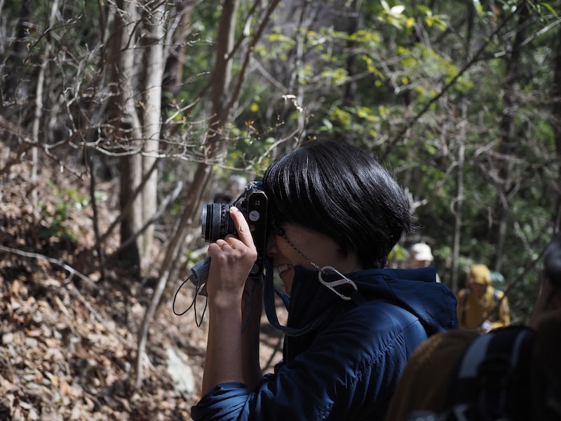
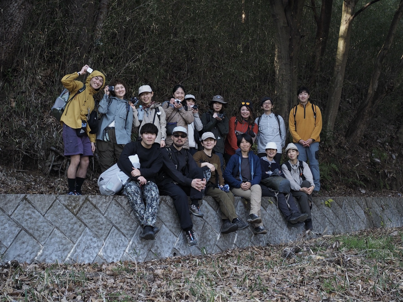
春の訪れを感じさせる、おだやかな陽光に恵まれた3月某日。and wander HIKING CLUBは山梨県の東側にある「八重山(531m)」へ、フォトトレッキングに出かけました。今回のハイキングクラブは直前にOUTDOOR GALLERY with PAPERSKYで開催された、写真家である野川かさねさんのエキシビション「Perspective」の関連イベントで、野川さんと一緒に写真撮影をしながらハイキングするというもの。スマートフォンやデジタルカメラなど、みんな思い思いのカメラを持参し、撮影のコツなどを教えてもらいながら、ゆっくりと春の里山を楽しみました。
八重山がある上野原市は、江戸時代に甲州街道の宿場町として発展。市のほぼ真ん中、JR上野原駅の背後を東西に流れる桂川の隆起と侵食によってできた起伏のある「河岸段丘」が特徴です。
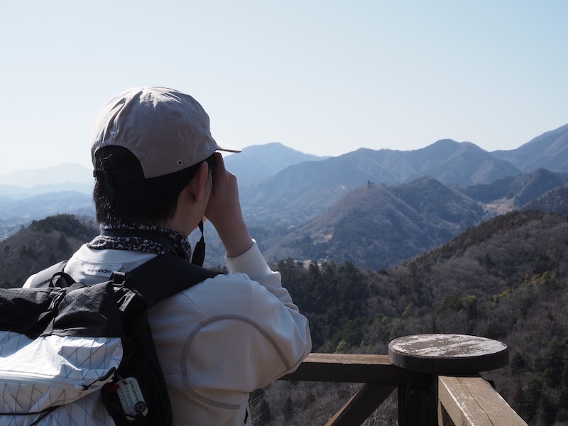
On a warm day in March, when the gentle sunshine hinted at the arrival of spring, and wander’s HIKING CLUB headed to Mt. Yaeyama (531m) in eastern Yamanashi for a photography trek. This trek was organised as part of the recent “Perspective” exhibition by photographer Kasane Nogawa that was held at OUTDOOR GALLERY with PAPERSKY. Nogawa herself accompanied the group, who documented the trek with their cameras as they hiked. Everyone brought their own preferred device, be it a smart phone or digital camera, and the group enjoyed the gentle hike through Yamanashi’s spring mountains while learning photography techniques from Nogawa along the way.
Uenohara city, where Mt. Yaeyama is located, developed as a post-station town on the Koushu Kaido, which was one of the Edo period Five Routes. It’s characterized by its undulating river terraces that were formed by erosion and deposition from the Katsura river that flows east to west behind JR Uenohara station, almost directly through the center of the city.
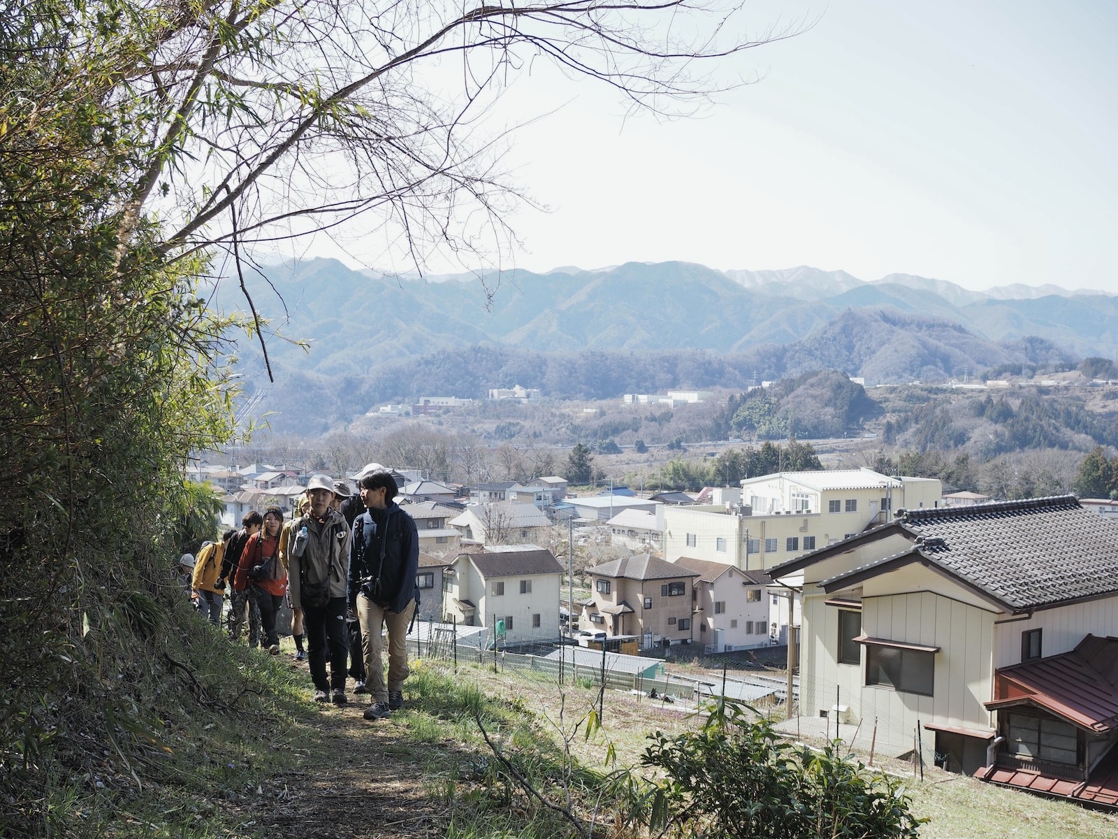
新宿から電車で約1時間という距離でアクセスも良く、気軽にハイキングを楽しめます。みんなが揃ったところで、ひとことずつ自己紹介をし合って、「向風(むかぜ)」行きのバスへ乗り込みます。
Being only approximately one hour from Shinjuku by train, Mt. Yaeyama is an easily accessible casual hiking destination. Once everyone has arrived we all introduce ourselves briefly before getting on the bus bound for Mukaze.
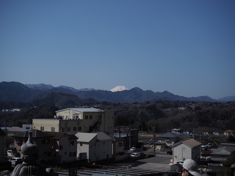
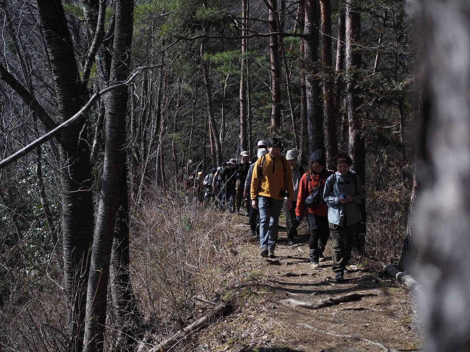
バスは15分ほどで登山口がある「光電製作所前」に到着。八重山へはいくつかのハイキングコースがあり、今回は虎丸山(468m)→能岳(542m)→八重山(531m)という3つの山を歩きます。バスを降りると至る所からまだ雪を被った富士山の頭が見えました。
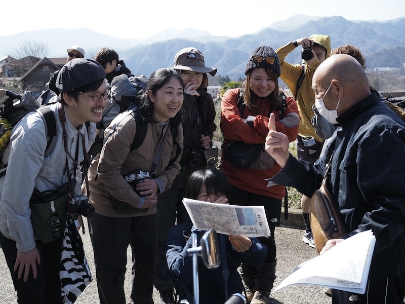
山道に差し掛かる直前、長年地元のバス会社に勤めていらっしゃったという名士に声をかけられ、手作りのマップをいただきました。山の整備にも関わっていらっしゃるとのことで、マップにはイキイキした情報が満載。
The bus takes about 15 minutes to reach the Kodenseisakusyo-mae bus stop where the trail begins. There are a few different hiking routes to Mt. Yaeyama. This time we will hike across three mountains: Mt. Toramaruyama (468m) → Mt. Nodake (542m) → Mt. Yaeyama (531m). After getting off the bus, we keep seeing a still snow-capped Mt. Fuji peeping its head out in the distance.
Just before we reach the mountain trail, we bump into a neighborhood celebrity who shares his hand-drawn map with us. As well as working for the local bus company for many years, he is also involved in maintaining the mountains, and the map was brimming with lively local information.
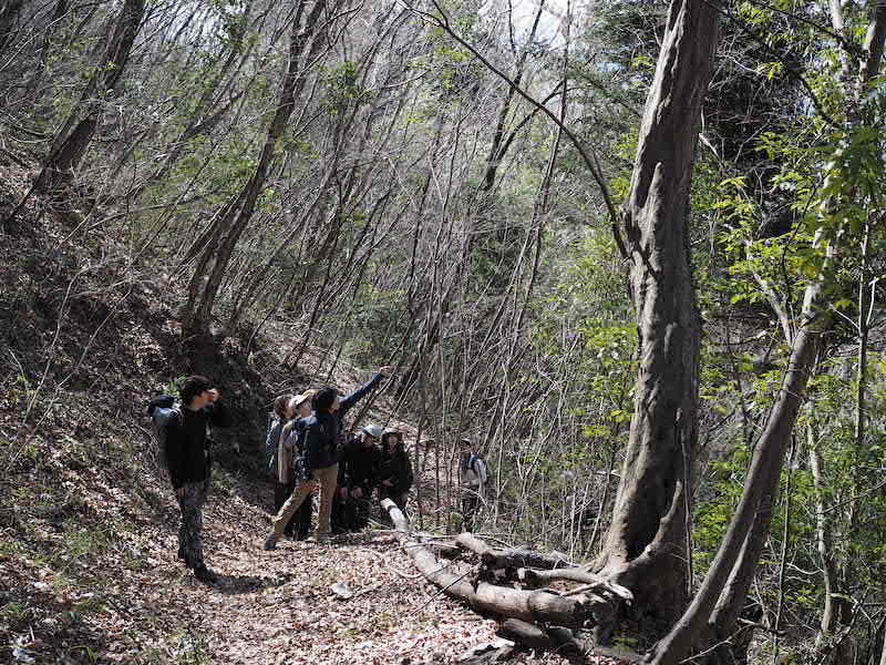
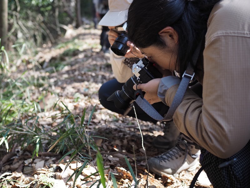
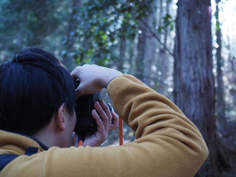
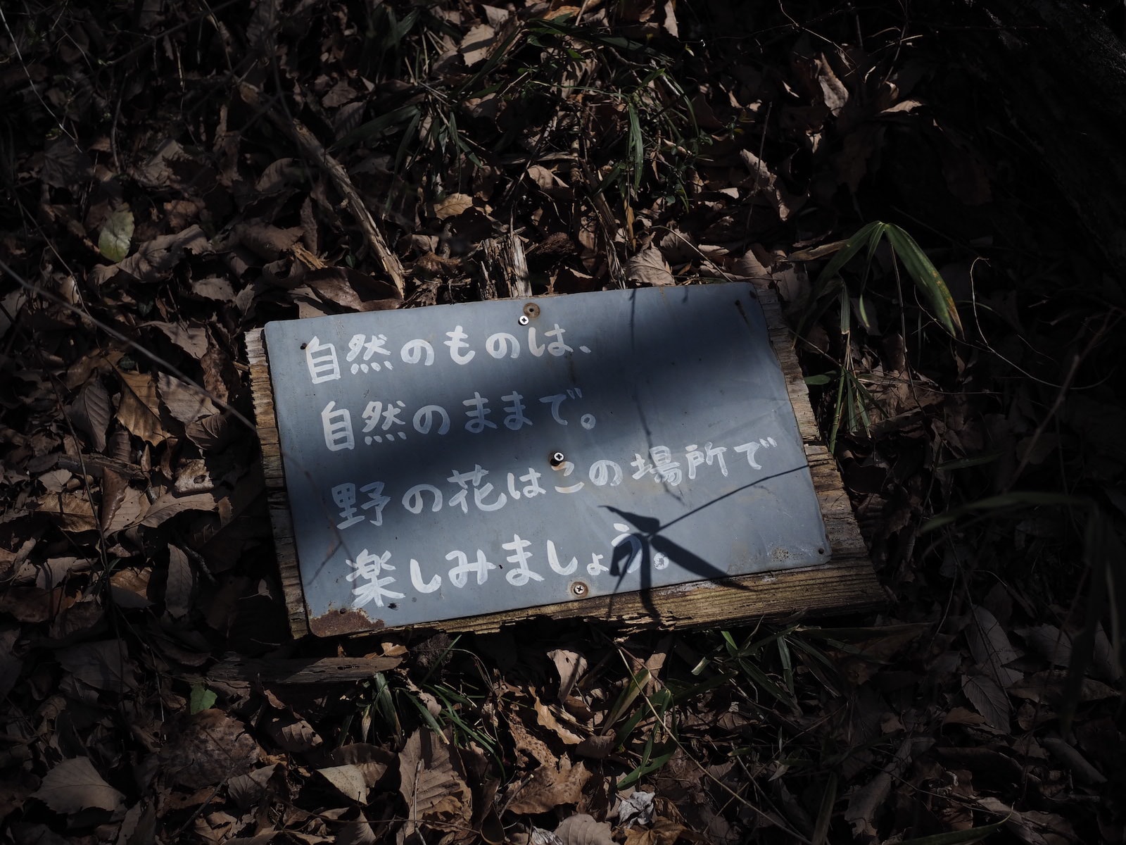
山に入るや否や、あちこちで撮影がスタート。野川さんもさっそく何か見つけたようです。セントウソウ(仙洞草)というかわいらしい白い花や、小さくて鮮やかなピンク色をしたハゼラン(爆蘭)、ゼンマイ(薇)の芽といった春の植物や、木漏れ日がつくり出すさまざまな形をした影、倒木に降り積ったかのような苔、鹿が樹皮をかじった跡などを、みなさんそれぞれの感性でとらえていました。
As soon as we enter the mountain, everyone starts taking pictures. Something appears to have caught Nogawa’s attention too. Everyone exercises their own artistic sensibility as they capture images of the forest around them. The forest is an endless source of inspiration: spring plants such as young fern buds, the delightful white flowers of the Chamaele Decumbens, and the small bright pink flowers of the Talinum Crassifolium; a range of differently shaped shadows created by the dappled sunlight; moss that looks like it has fallen and settled on top of fallen tree trunks; and bite marks where deer have nibbled tree bark.
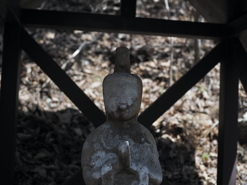
しばらくいくと小さな祠の中に穏やかな表情をした馬頭観音が佇んでいました。上野原の馬頭観音はめずらしい柔和な顔で、無病息災、動物救済、厄除け、旅行安全などのご利益があるとされているのだそう。
A little bit further on, we come across a gentle-faced Bato Kannon (horse-headed kannon) standing inside a small shrine. The Bato Kannon of Uenohara are unusual for their gentle facial expressions, and are said to bring good health, protect animals, ward off evil, and ensure the safety of travelers.
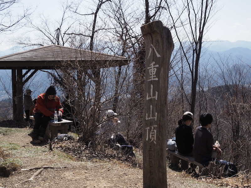
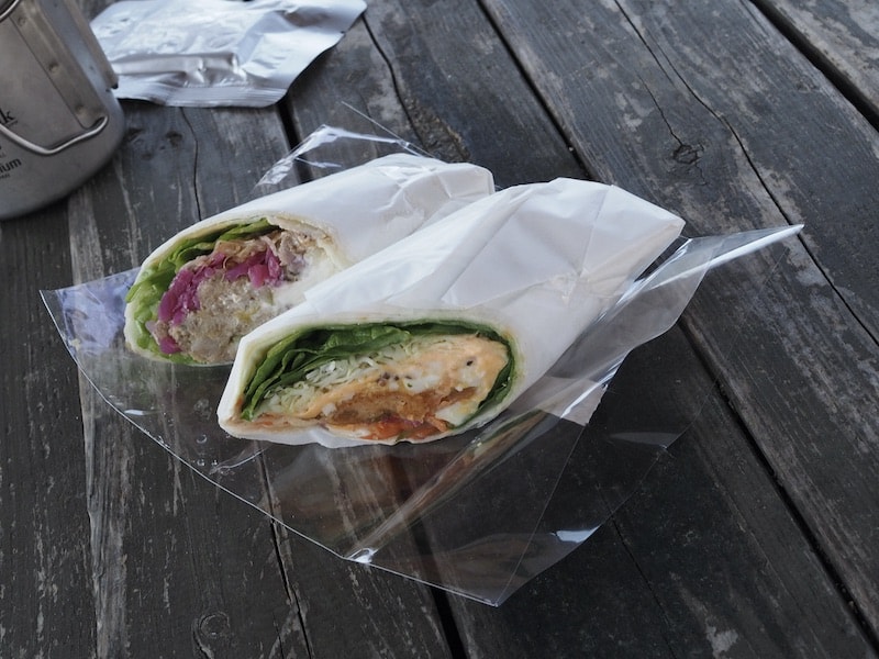
能岳山頂を経由して尾根伝いに歩き、休憩に適した東屋がある八重山山頂に到着。ランチはHIKING CLUBでも大人気、クラフト・レトルトフードメーカーの「ONE POT WONDER」による豚とパイナップル、そしてタルタルフィッシュの2種のラップサンド。
食後はみんながこれまで撮ってきた写真を見せ合いながらのカメラ談義が始まり、一枚ずつ大事そうにシャッターを切るフィルムカメラや、中には「数年ぶりに電源を入れました(笑)」なんてカメラを持ってきた方も。遊び方はさまざま。
We reach the top of Mt. Nodake and then continue walking along the mountain ridge to the summit of Mt. Yaeyama where there is a shelter that is well suited for us to use as a rest spot. For lunch, we enjoy two different wrap sandwiches — pork with pineapple, and fish with tartar sauce, both from HIKING CLUB favourite: craft boil-in-the-bag food maker ONE POT WONDER.
After lunch we all show each other the pictures we’ve taken so far, and then the camera talk starts. One person has brought a film camera where each click of the shutter is precious, while another participant admits that it’s the first time their camera has been turned on in years! There are so many different ways to enjoy photography.
実はこの八重山は、1929(昭和4)年に同地で生まれ育った水越八重さんという方が「お世話になったふるさとや子供たちのために役立ててほしい」との願いを込めて市に寄付された山林。山の一部はふもとの上野原小学校の学校林として、児童らの学習の場にもなっています。
Mt. Yaeyama is actually an area of countryside that was donated to the local city in 1929 by Yae Mizukoshi, who was born and brought up there. She wanted it to be put to good use for her hometown and for local children. Part of the mountain is now used as a forestry school for the Uenohara elementary school, which is located at the bottom of the mountain, providing a learning space for its students.
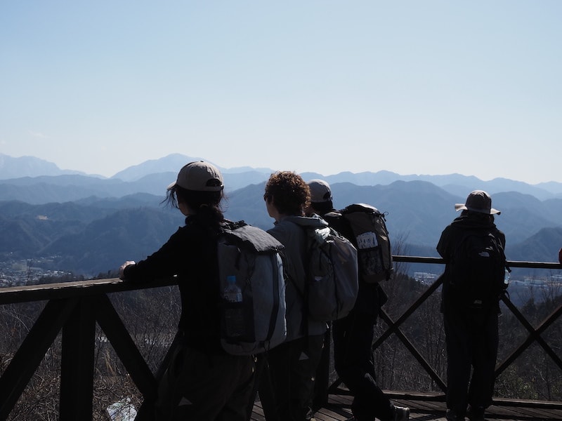
八重山は「五感の森」としても知られており、一年を通じて、みる、きく、かぐ、さわる、あじわうという楽しみ方ができます。頂上から少し降ったところにある展望台からは、上野原市街を眼下に、丹沢山系や東海自然歩道の山々を望めます。
Mt. Yaeyama is also known as a “forest of the five senses” and throughout the year people can enjoy the experience of seeing, listening, smelling, touching, and tasting Mt. Yaeyama. From the viewpoint located a little bit below the summit, you can look out over Uenohara city towards the Tanzawa mountains and the Toukai Nature Trail.
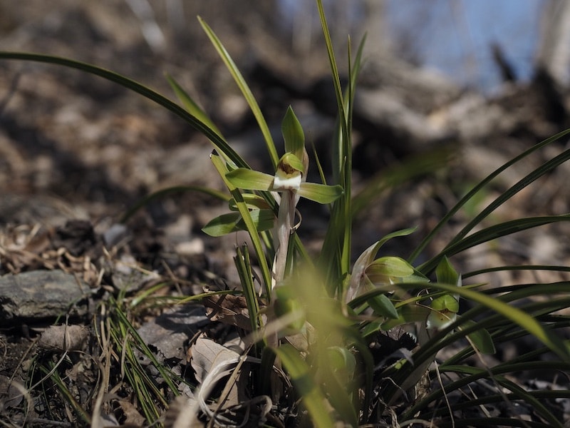
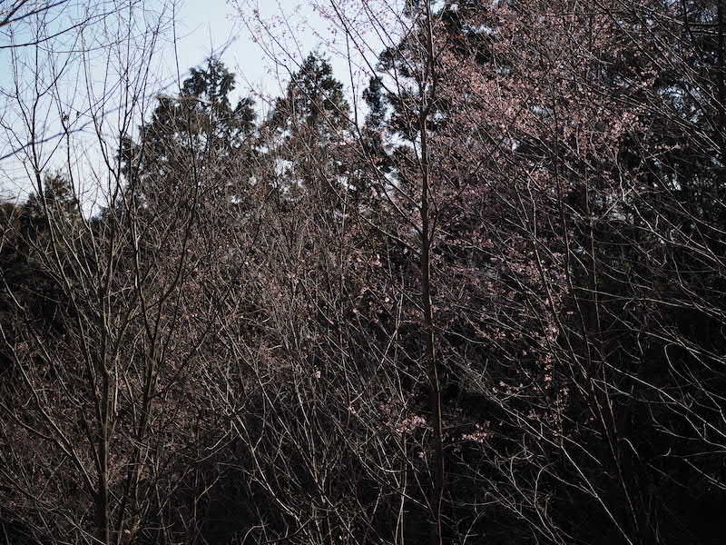
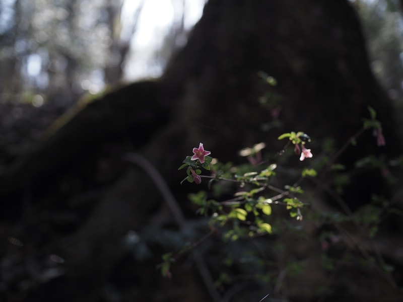
「飾らない心」という花言葉を持つシュンラン(春蘭)や、時雨のように可憐に花をつけた寒桜が少しだけ咲き始めていました。歩き始めてからから約4時間、たっぷりと五感を刺激した八重山ハイキングもそろそろ終盤です。
The Cymbidium goeringii or “Nobal Orchid”, which means “undecorated soul” in floriography, is just coming into bloom, as are the winter cherry blossoms, whose pretty flowers look like dew clinging to the tree branches. After four hours of walking, and experiencing our environment through all five of our senses, we are near the end of our Mt. Yaeyama hike.
帰りは上野原中学校のすぐ脇にある登山口に出て、徒歩で20分ほど歩いて大堀のバス停へ。終始朗らかな天候に恵まれて、みんなも気持ちよさそうでした。カメラのことや、各地の山のことなど、野川さんとの会話も楽しみながら、おもむろに「あ!」と、立ち止まってはカメラを構えるような場面ばかり。土地の風土や、山中で出会った一瞬など、生きた被写体を存分に味わった今回のハイキングクラブ。
八重山周辺はこれからの季節、さらにたくさんのお花が見られるようになるそうです。ぜひカメラを持って遊びに出かけてみてください。
On the way back, we exit the mountain at the end of the trail next to Uenohara Junior High School before walking about 20 minutes to the Ohori bus stop. Blessed with good weather from start to finish, it was a very pleasant hike for everyone. We all enjoyed talking with Nogawa about cameras and about various other mountains as we walked, our hiking periodically interrupted by someone suddenly exclaiming “ah!” and stopping to take a picture. This HIKING CLUB was a chance to experience photographing “live” subjects, be they the singular moments of our mountain experience or the natural features of the land.
Now is a great season to see even more flowers come into bloom in the Mt. Yaeyama area. Why not grab your camera and head out to explore it, too?
【ハイキングクラブ一行が辿ったコース】
山名:八重山
場所:山梨県 上野原市
標高:531m
距離:約5km(春蘭コース)
行程:上野原駅南口(9:00)…上野原駅南口バス停[向風行 9:41発]…大堀バス(9:55)…八重山登山口(10:05)…春蘭コース(11:15)…八重山山頂(11:25)[休憩65分、12:30発]…展望台(12:45)…八重山登山口(13:25)…大堀(13:45)…上野原駅(14:30)
[The route taken by the HIKING CLUB]
Mountain name: Yaeyama
Location: Yamanashi prefecture, Uenohara city
Altitude: 531m
Distance: approx. 5 km (Shunran route)
Route: Uenohara station south exit (9:00) — Uenohara station south exit bus stop [9:41 bus bound for Mukaze] — Ohori bus (9:55) — Yaeyama trailhead (10:05) — Shunran route (11:15) — Yaeyama summit (11:25) [rest 65 mins, depart 12:30] — lookout point (12:45) — Yaeyama trailhead (13:25) — Ohori (13:45) — Uenohara station (14:30)
translation Yuko Caroline Omura