

2023.04.28
Report | Maison Kitsuné × and wander
HIKING CLUB in Mt. Sekirouand wander journal #61
Maison Kitsunéとand wanderによる新たな試み
2002年にパリで設立された「Maison Kitsuné(メゾン キツネ)」とand wanderによって、2023年春夏シーズンに誕生したコラボレーションは、パリと東京、ファッションとカルチャー、ジェンダーやエスニシティの間に「境界線」を引かず、ひとつに繋がりあった広い世界を舞台として想いを共創させた新たなものづくりへの挑戦です。
Maison Kitsunéの創造性と、and wanderの機能性を融合させて生み出されるハイキングウェアのコレクションには、都市から山へ、また山から都市へと着るもののアクティビティに自由をもたらす精神が宿っています。そのことを示すかのようにコラボレーションの一環として企画された特別版のHIKING CLUBレポートをお楽しみください。
木の芽、草の芽ふくらむ、春の石老山
春分の日の朝。JR相模湖駅にHIKING CLUBへの参加者が続々と集まってきました。この日、一行が目指すのは丹沢山地にある「石老山(702m)」。神奈川県の水ガメでもある相模湖の南に連なる関東百名山のひとつでもあり、平安時代(876年)に建立された顕鏡寺や、山間に現れる奇岩怪石で知られるほか、主要な登山ルートは東京・八王子の高尾から大阪の箕面までの長さ1,697km(!)の「東海自然歩道」の一部にもなっています。
また神奈川県の広域に上水道や工場用水を供給する相模ダム(1947年竣工)によって堰き止められて作られた「相模湖」は、1964年の東京オリンピックの際にはカヌーの競技会場としても利用されました。交通アクセスにも優れ、駅から湖まではほんの500mほど。
A new adventure by Maison Kitsuné and “and wander”.
The 2023 Spring collaboration between “Maison Kitsuné” (founded in 2002 in Paris) and “and wander” is a new creative adventure into a world of diverse co-creation that effaces the boundaries between fashion and culture and transcends gender and ethnicity.
The hiking gear collection combines the creativity of Maison Kitsuné and the functionality of and wander. It creates a sense of freedom around what you wear and what you do, taking you from urban settings to mountain trails and back to the city. I hope that you will enjoy this special edition HIKING CLUB report, written as part of this collaboration.
New buds and young grass - Mt. Sekirou in the spring
It’s morning on the vernal equinox (March 21st). Today’s HIKING CLUB participants meet at JR Sagamiko station. Today the group will be heading to Mt. Sekirou (702m) in the Tanzawa mountain range. Mt. Sekirou is one of Kanto’s “100 most famous mountains” and is situated to the south of Lake Sagami, an artificial lake that provides water to Kanagawa prefecture. Apart from being known for its Heian period (876) temple “Kenkyo-ji” and its fantastic rock formations, Mt. Sekiro’s main hiking route is also part of the 1,697km (!) long “Tokai Nature Trail”, which connects Takao in Hachioji, Tokyo to Mino in Osaka.
Lake Sagami was formed with the building of Sagami dam (completed in 1947), which supplies the public water system and industrial water across a wide area in Kanagawa prefecture. The lake was also the venue for the 1964 Tokyo Olympics canoeing competition. The lake is only about 500m from the train station, making it easily accessible by public transport.
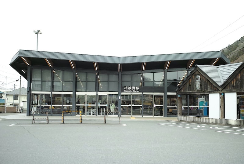
新宿から電車に乗って1時間ほどで着いてしまうJR相模湖駅。停車する本数は多くないものの、日帰り登山には大変便利です。目的の石老山の登山道入口まで、ここから約6kmの距離。バスが1時間に2~3本くらい出ていますが、湖沿いに歩いても1時間半ほど。健脚の方にとってはロングハイキングのようで気持ち良い距離かもしれません。
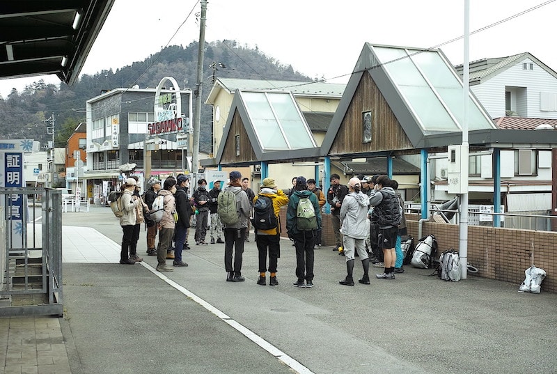
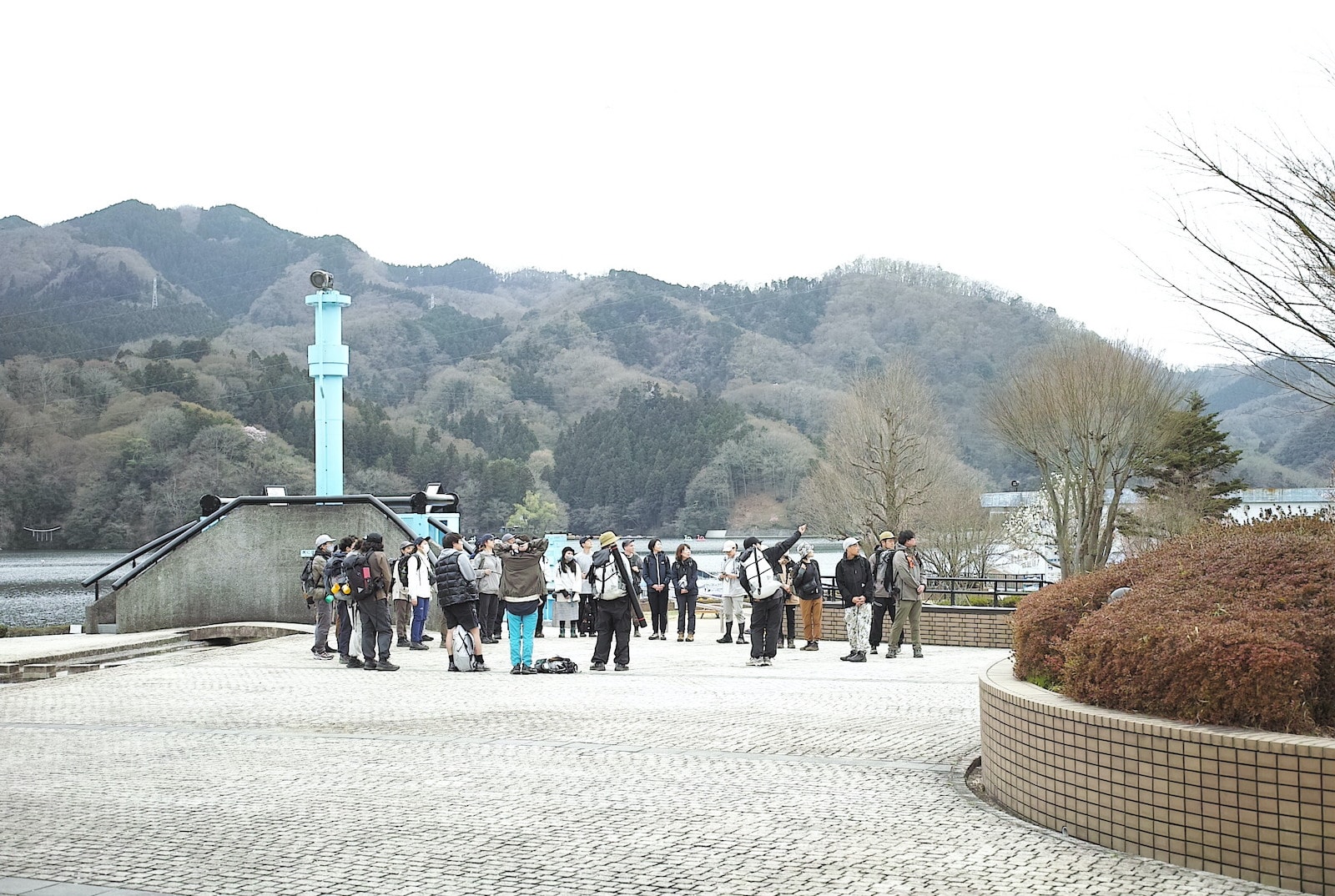
さて、参加者全員が揃ったことを確認し、みんな一言ずつ自己紹介をして出発です。まだちょっと緊張気味のようす。駅前のバス乗り場から「三ヵ木(みかげ)」行のバスに乗ると、すぐに相模湖と石老山が見えてきます。“神奈川の橋100選”にも選ばれている相模湖大橋や嵐山洞門といった名所を過ぎ、登山口のある「石老山入口」で下車します。
After spending about one hour on the train from Shinjuku, you will arrive at Sagamiko station. Although there are not so many trains that stop there, it’s the perfect destination for a hiking daytrip. From here, it’s approximately 6km to the start of the trail to go up Mt. Sekirou. A bus runs about 2 to 3 times an hour. It also only takes about 90 minuets to walk along the lakeside to get there. For confident walkers, this could be a pleasant additional walk to make for a longer overall hike.
After checking that everyone has arrived, it’s time for some quick self-introductions before setting off. At this point the group is still a bit nervous. We board a bus bound for “Mikage” from a bus stop in front of the station. After pulling out of the station, Lake Sagami and Mt. Sekirou very quickly come into view. We pass some sights such as “Lake Sagami Ohashi”, which was chosen as one of “Kanagawa’s 100 Best Bridges” and “Arashiyama Tunnel” before getting off at the “Sekirou-zan Iriguchi” stop for the trailhead.
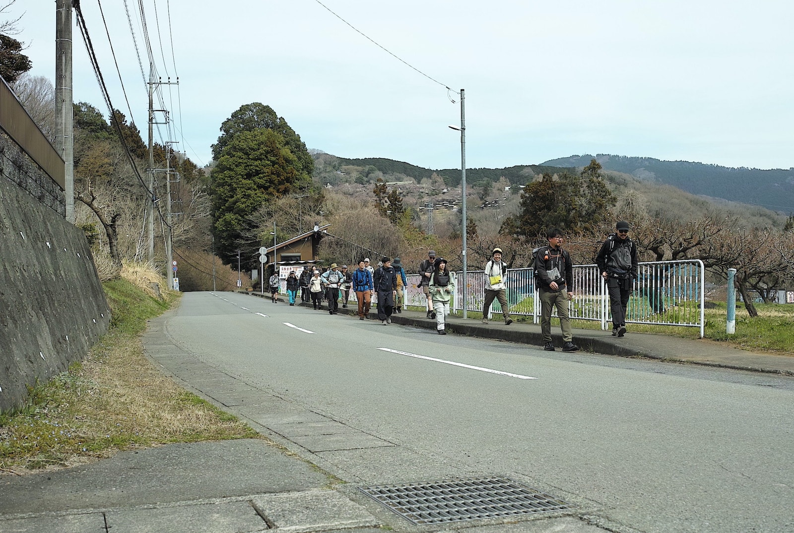
バスを降りたら、しばしのどかな風景のなかを歩き、登山道入口へと向かいます。早咲きの河津桜がもう咲いていましたが、ここでは地元の地名にちなんで「阿津桜」と呼ばれているようです。登山口までは道案内の看板が何度も出てくるので迷うことはありません。のんびり歩きながら、みんな何を話しているのでしょう? 時折お日さまも顔を出し、少しずつ体も温まってきます。
After getting off the bus, we walk along some pleasant rural roads for a while as we head to the start of the hiking trail. The early blooming Kawazu cherry trees are already blossoming, although here they are known as “Azu Sakura” after a local place name. The route to the start of the hiking trail is well signposted, so there’s no way to get lost. Everyone chats as we amble along and our bodies also start to warm up with the sun breaking though now and again.
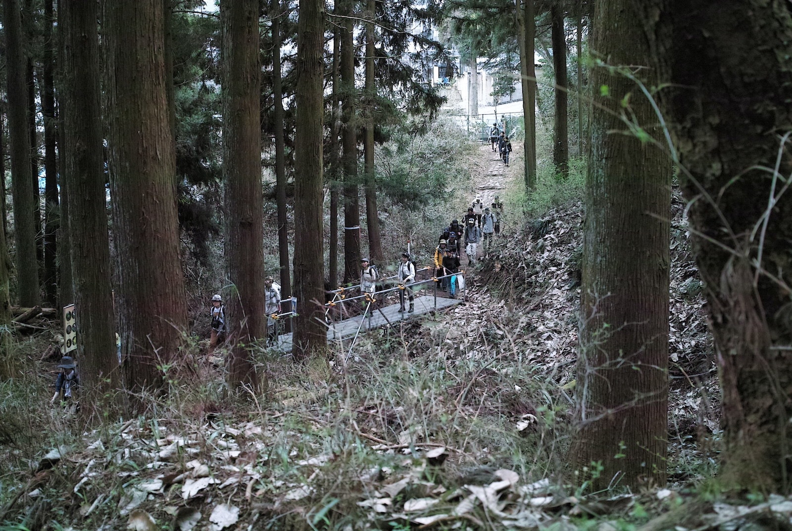
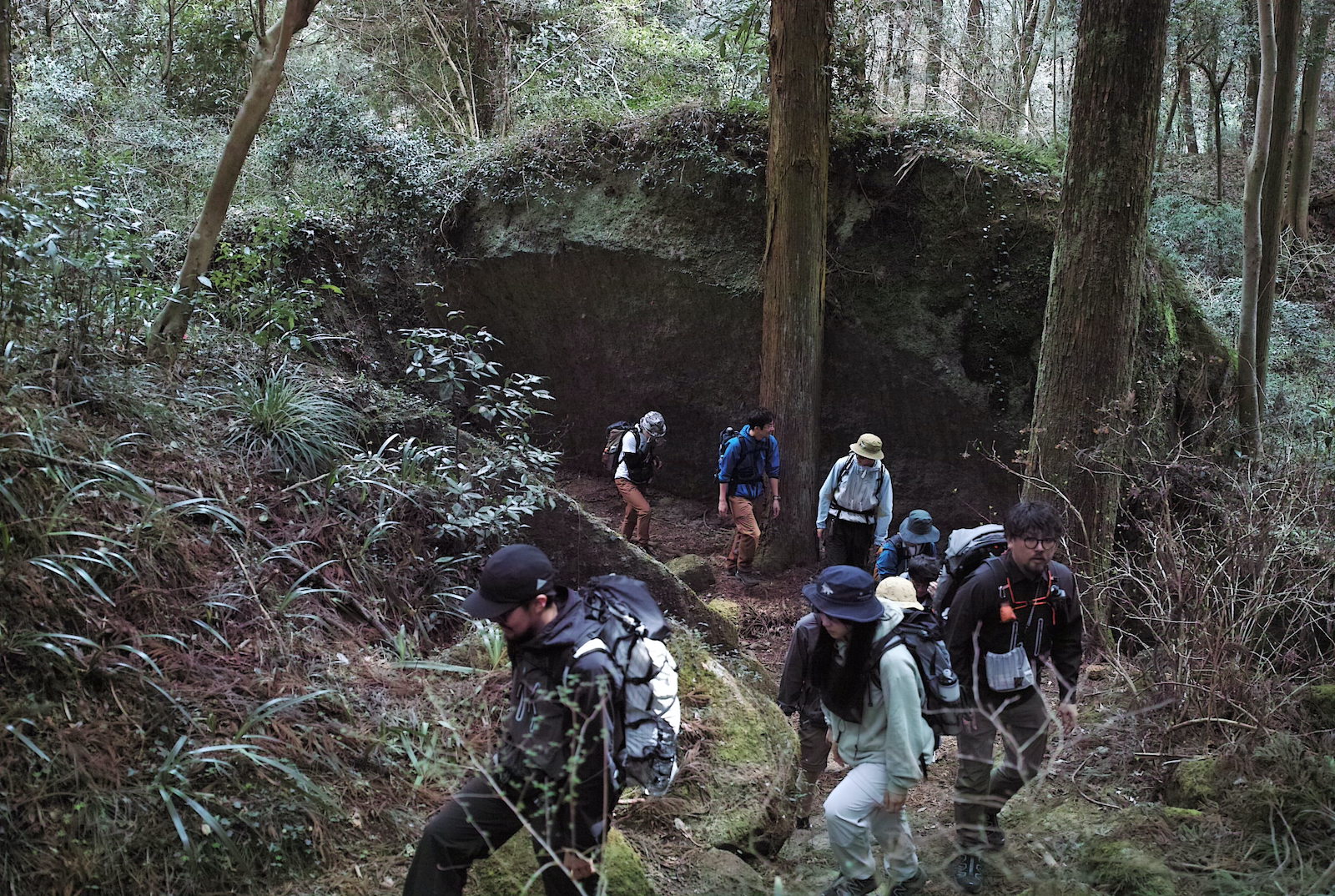
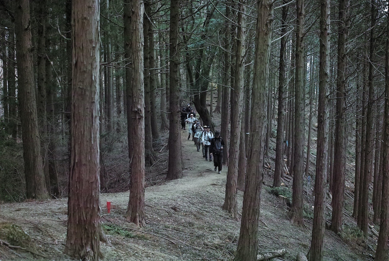
いよいよ登山開始です。屏風岩や仁王岩などの奇岩怪石が待っている石畳の山道を30分ほど歩き、中腹にある「顕鏡寺」を目指します。次々と現れる大きな岩に圧倒され、一体いつ、どんなふうにしてこんな大きな岩が…と不思議に思ってしまいますが、実は約600万年も前に、深さ数千メートルの海の底にできた「溝」に、小さな石や砂が溜まって固まってできた礫岩(れきがん)という岩がその正体で、果てしなく長い時間をかけて押し上げられて山になったのだそう。つまり「もともとは海の底にあった」道なのですね。するとみなさんは「600万年前の海の底」を歩いているわけです。不思議ですね。
Let the hike commence! For about 30 minutes, we walk along a stone paved path that takes us past some very unique and striking rock formations such as the “Byobu-iwa” or “folding screen rock” and another giant rock known as “Nio-iwa”. This path takes us to “Kenkyo-ji”, which is located about half way up the mountain. Faced with giant rock after giant rock, we are overwhelmed by their sheer size and presence, and wonder how such huge rocks could have gotten here. Actually, these giant rocks originated as rocks known as “conglomerates”, which were formed around 6 million years ago from small pieces of stone or sand that got trapped in groves on the seabed, thousands of meters below the ocean’s surface. These pieces of stone or sand were compacted together to form the conglomerates that, over an extremely long period of time, were pushed up from the seabed to form mountains. In other words, this path “used to be at the bottom of the ocean”. Meaning that the group is walking along a “6 million-year-old seabed”. Isn’t that just amazing to contemplate!
高さ4.5m、幅7mの「屏風岩」の切通しを行きます。岩の側には個別の伝説を記した標識があり、一つひとつを読みながら登っても楽しいです。その岩の名はこの先にある顕鏡寺が建立された平安時代に名付けられたのでしょうか。1000年以上も昔に、この地を訪れた人々も僕たちと同じように「一体なぜこんなところに大きな岩が…」と思ったはず。
We walk through a cut in 4.5m high, 7m wide “Byobu-iwa” (folding screen rock). There are signs on the side of the rock, each recounting a different legend, and it’s fun to read them all as you walk. We wonder if this rock was given its name during the Heian period, around the same time that the temple “Kenkyo-ji” was built. The people who walked these hills over 1000 years ago must also have also wondered “why is there such a gigantic rock here?”.
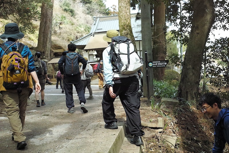
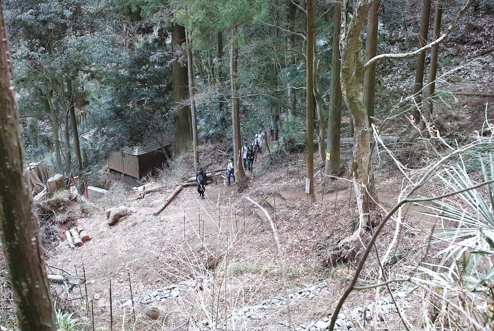
顕鏡寺に到着。石老山の名の由来をはじめ、たくさんの伝説を持つ大変古いお寺です。バスを降りて歩き始めてからここまで約40分ほど。だいぶ体も温まってきたので、ウェアリングを確認してから登山を再開します。顕鏡寺まではやや鬱蒼とした樹林の中を歩いてきましたが、ここから標高が上がるにつれて徐々に視界がひらけてきます。まだ少し急登が続くものの、山道はよく整備されていて登りやすいので、急がずにステップを小さくとってゆっくりと行きましょう。
We arrive at “Kenkyo-ji”, an extremely old temple that is the subject of many legends, including a story about the origin of Mt. Sekirou’s name. It’s taken us about 40 minutes to get to this point from when we stepped off the bus and started walking. Now that we’ve warmed up quite a bit, we check our gear before starting the rest of the hike. Up until “Kenkyo-ji” we have been walking through rather dense forest, but from here on, as our altitude increases, our surroundings will become more open. Although the path is still quite steep, the trail is well maintained and easy to tread, and we take it slowly with small easy steps.
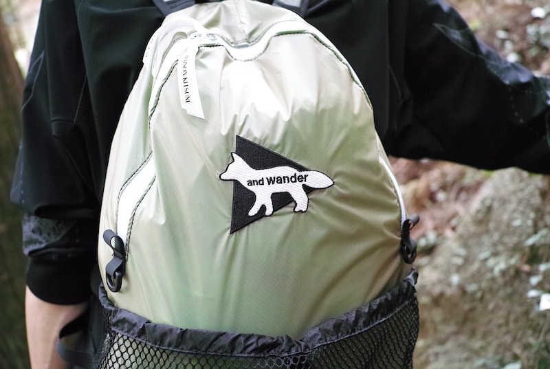
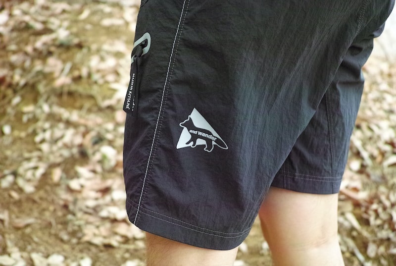
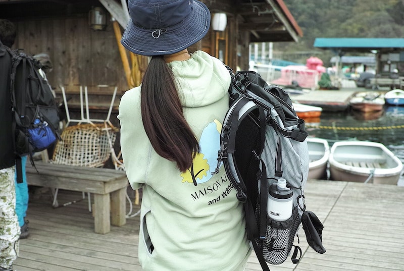
「Maison Kitsuné」とのコラボレーションは山々と都市を越境する汎用性の高いデザインのウェアや小物が幅広く展開され、参加者の装備の至る所にキツネのマークが。この時点ではまだ、みなさんは知りませんが、山頂では「Café Kitsuné」からドリップコーヒーのプレゼントも待っていました。
The collaboration with Maison Kitsuné includes a wide range of clothes and accessories with highly versatile designs that transcend the border between urban and alpine. As we walk we notice the little fox logo present on many of the items worn or carried by our participants. Although they don’t know it yet, a drip coffee, courtesy of “Café Kitsuné”, awaits them at the summit.
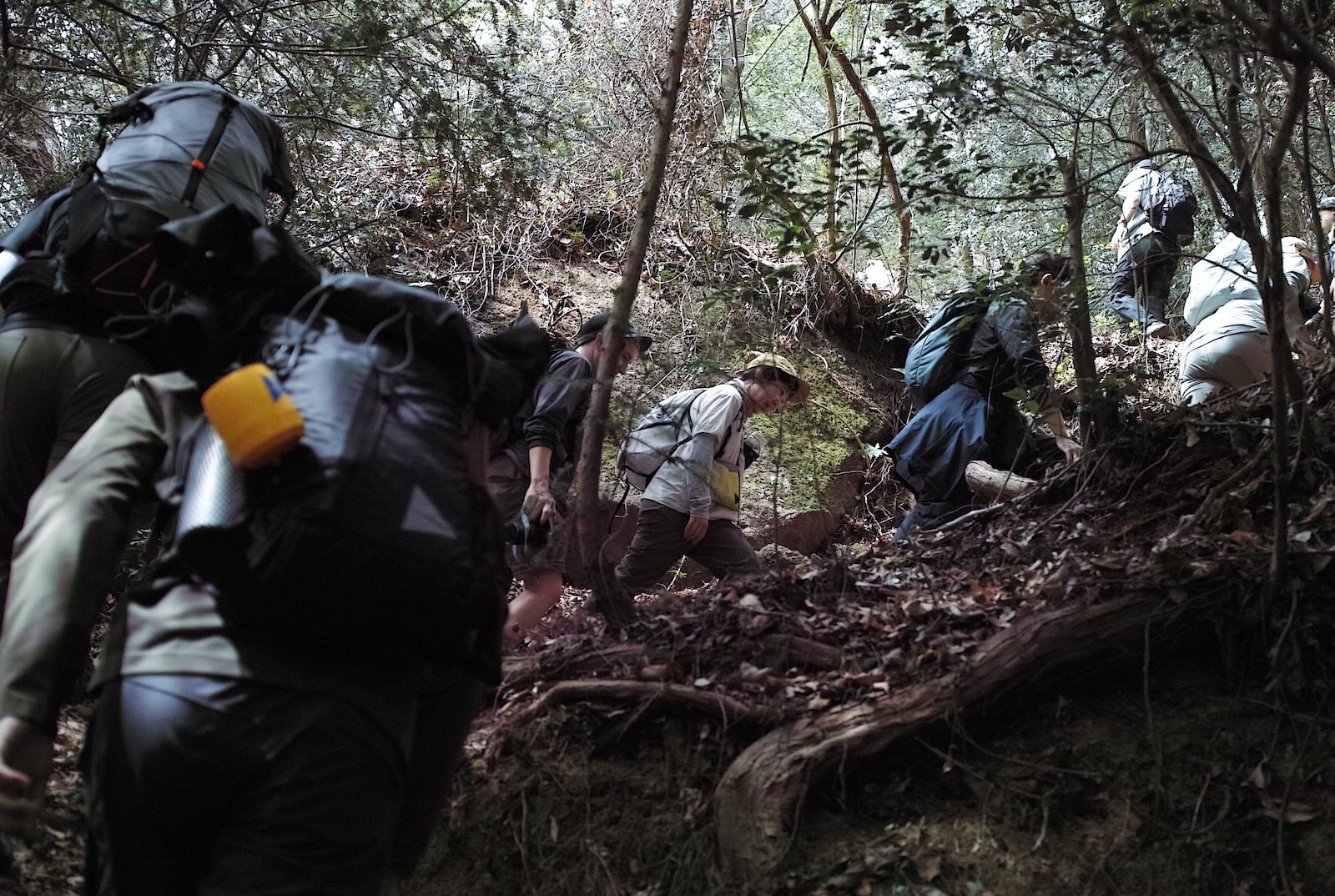
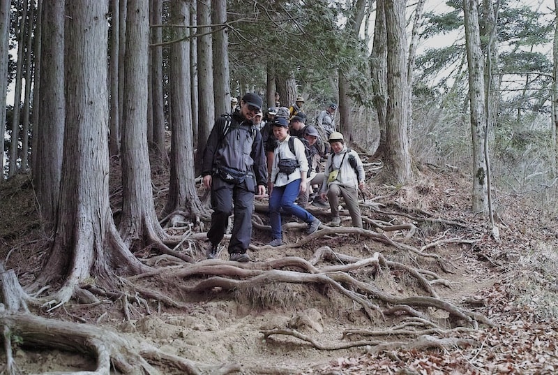
地表を這う木の根、変幻自在の傾斜とカーブ。山ではさまざまな路面の変化に対応するために全身を駆使します。ただ無心になって山道を歩いているつもりでも次から次へと方向転換の連続。一歩一歩、足を置く位置に配慮して頭と身体を進行方向に移動させ、腕を降って勢いをつけたり、木に捕まってブレーキにしたり。あらためて考えてみると、山登りは本当に複雑な全身運動なのだとわかります。
Tree roots that crawl along the ground and ever-changing slopes and corners - when hiking our whole body must be ready to respond to the numerous changes in terrain. Even when you think you’re simply concentrating on the hiking trail, you are actually responding to turn after turn. Step after step, we continually adjust the position of our body according to our next step, always facing the direction of travel. We also use our arms to give us more momentum, or to grab hold of trees and use them to brake. Thinking about it this way, we become aware that hiking is actually a complex full-body workout.
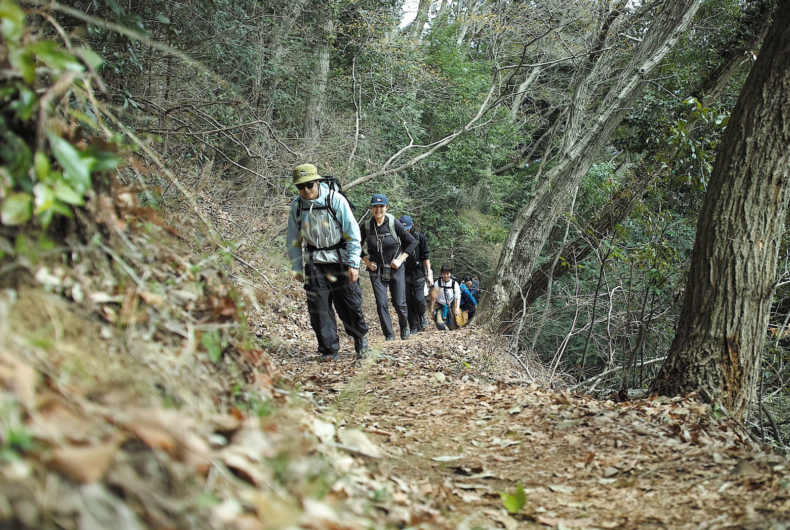
途中、視界抜けの良さそうなスポットを見つけて参加者のみなさんを撮影していると、笑顔と笑い声がどんどん通り過ぎていきます。急登を過ぎてなだらかな道が続いているせいでしょうか。登り始めて1時間半ほどですが、みんなはまだまだ元気のようです。おいしいランチが待っている頂上まで、もうすぐですよ。
Finding a spot with a clear view, I photograph the group as they walk past me and I am greeted with a string of smiles and laughter. Maybe this is because we have passed the steep climb and have reached a relatively gentle climb. It’s been about an hour and a half since we started the hike, but everyone still seems to have plenty of energy. It’s not far now to the summit, where a delicious lunch awaits us all.
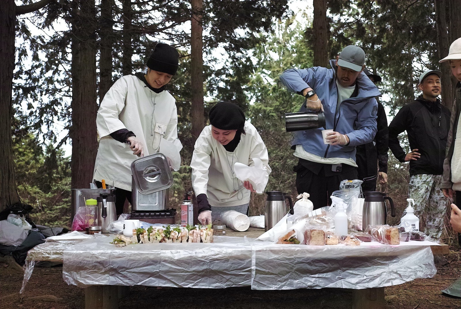
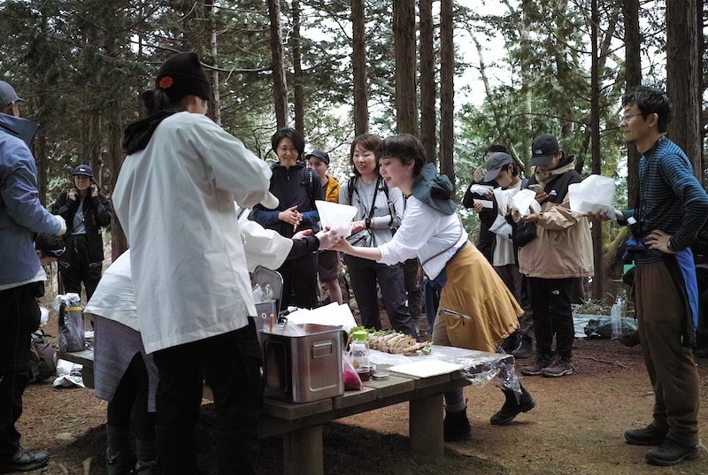
さあ山頂に到着。笑顔の裏ではみなさんやはりお腹がペコペコだったようです(笑)。今回のケータリングを担当してくれたのは「ONE POT WONDER」チーム。「アウトドアに楽しい食卓体験を」をテーマに、外で食べるご飯を最高においしくする活動をしています。実はこの日、HIKING CLUB本隊よりも1時間先に出発し、寒い中、頂上でランチの準備をしながらみんなの到着を待っていてくれました。ありがとうございます。
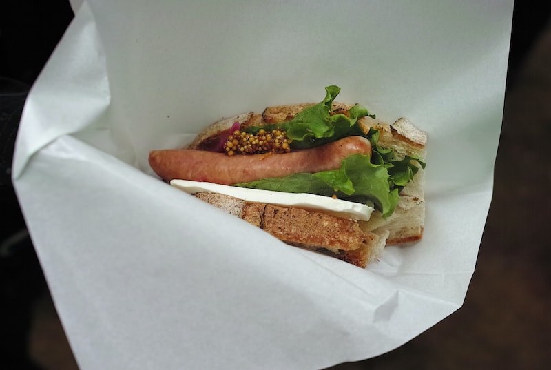
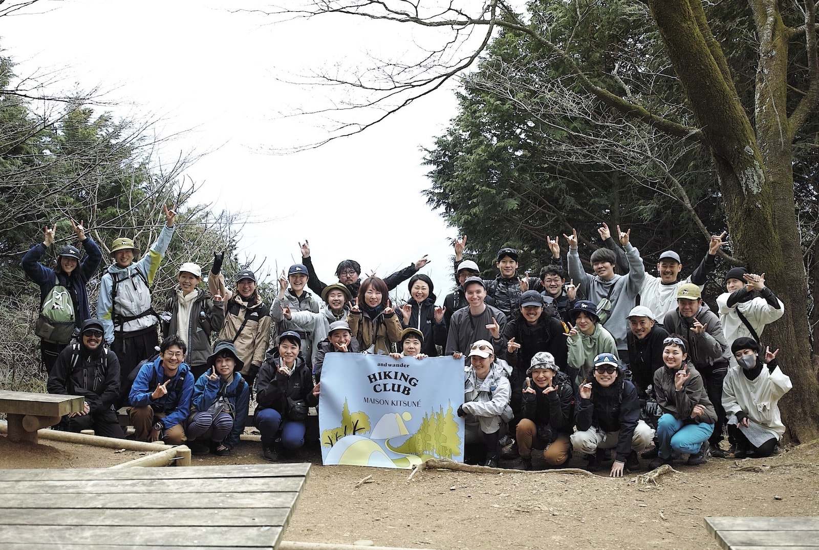
やさしい気持ちがこもったソーセージ・サンドウィッチと3種類の温かいスープ、焼き菓子、ホットコーヒーと、盛りだくさんのメニューがテーブルに並び、あちこちから「おいしい!」の声が上がります。中でも水を使わずに玉ねぎとお塩だけで作ったというオニオンスープやサンドウィッチに使われていたカルダモンとオレンジのマスタードが絶妙でした。お代わりさんが続出する中で約1時間、ゆっくり休憩を楽しんだ後は恒例の記念撮影です。ハイ!みんなでキツネポーズ。
We made it to the top! It would seem that behind all those smiles, everyone was actually very hungry! A team from “ONE POT WONDER” has provided the catering for this trip. Their motto is “to bring fun dining experiences outdoors”, and their products are designed to make the food we eat outdoors the best it can be. On this day, they actually set off one hour before the HIKING CLUB group, and worked despite the cold to prepare our lunch at the summit in advance of our arrival. Thank you!
A lavish menu of heartwarming sausage sandwiches, three different kinds of hot soup, baked treats and hot coffee fills the table. Calls of “oishi!” (it’s delicious) can be heard coming from all over the group. The onion soup, made with just onion and salt without any water and the cardamom and orange mustard used in the sandwiches are especially delicious. With lots of people coming back for seconds, we rest for about one hour before the customary group photo. Let’s see a “kitsune hand” from everyone please!
さてお腹も満たされて、いざ後半戦のスタート。1時間ほど尾根伝いに歩いて大明神展望台へ。比較的起伏の少ない降り基調の道ですが、突如現れる丸太の階段や岩と地面の間の高い段差に注意。大きく歩幅を取ると着地にかかる衝撃も強くなるので、なるべく小さなステップでジグザグ。ゆっくり降りていきましょう。
Now that everyone has eaten their fill, we set off on the second half of the hike. We walk for about one hour along the mountain ridge towards “Daimyojin” lookout. Although this section is a gentle descent with relatively few ups and downs, you need to watch out for the unexpected log stairs or the large steps between rocks and the ground. Taking long strides increases the impact on landing, so it’s best to take smaller steps and zigzag along the path. Let’s take our time.
気持ちの良いストレートな山道。地表から真っ直ぐに伸びた杉の林のなかを歩きます。これらの樹々の根が地中へ深く複雑に伸び広がっていることを想像すると、なるほど雨が降っても土砂が流れ崩れない理由が想像できます。樹の根一本一本の力が無数に集まって、ひとつの山の形を維持しているのですね。
We come across a satisfyingly straight mountain path. We walk through a forest of Japanese cedar, their trunks extending straight up out of the ground. If we imagine that the roots of these trees are reaching deep down into the ground beneath our feet, all complexly intertwined, it’s easy to understand how the ground remains solid even after heavy rains. The power of an infinite number of individual roots is combined to hold up the mountain.
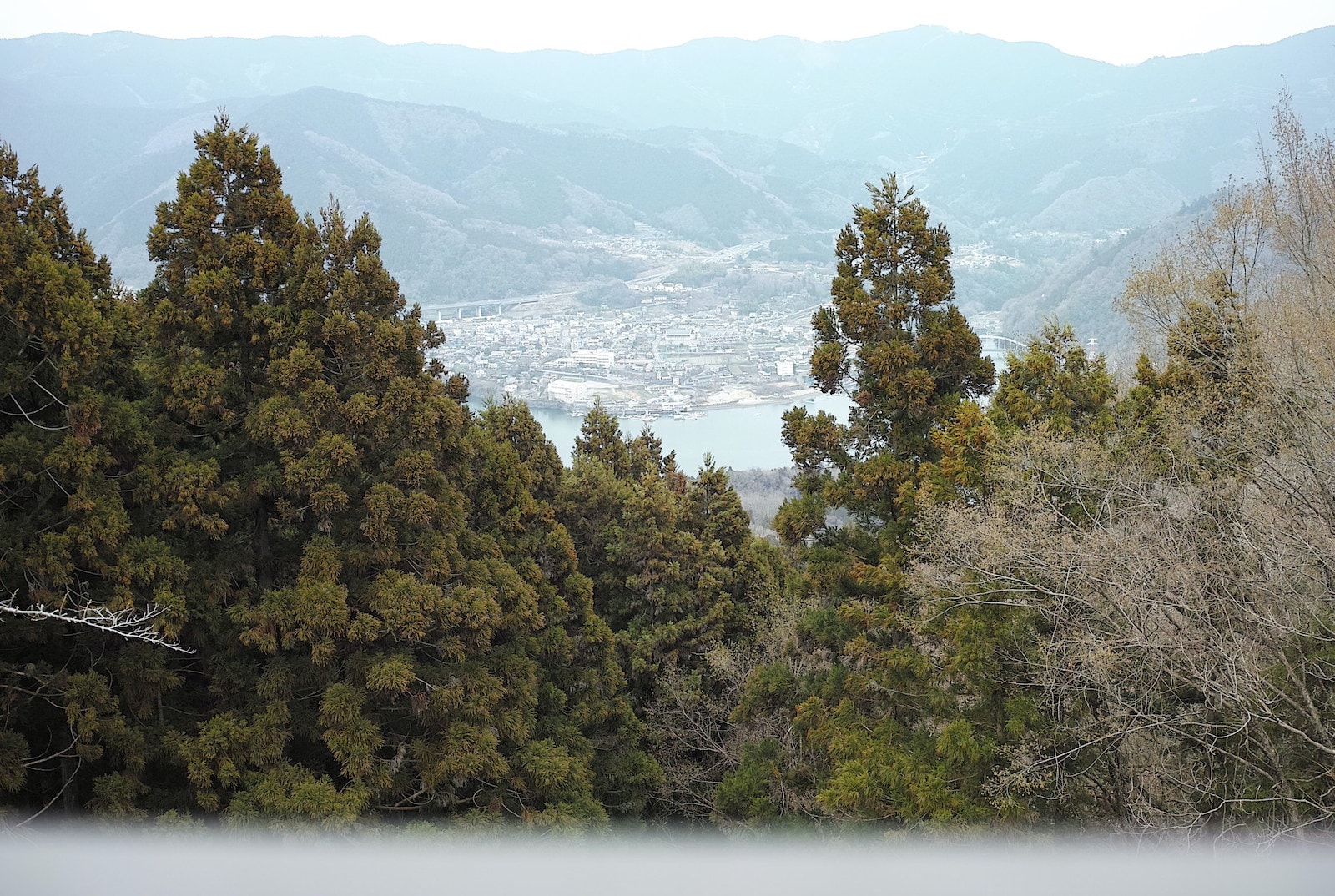
やがてきれいに整備された大明神展望台に到着。北西には相模湖の向こうに陣馬山や景信山といった奥多摩の山々が見えます。登山開始からは3時間余り。この頃になるともうみんな顔見知りになって和気あいあいとした雰囲気が一向を包みます。一緒に山歩きをした仲間という連帯感も、登山の魅力のひとつかもしれません。
展望台を過ぎると「ねん坂」と書かれた案内が現れました。ルート上の名所、または難所なの? とつい身構えてしまいますが、本来は「鼠坂=ネズミが通るような狭い坂」と書き、そういう箇所があるのではなく、下山した先の集落の地名なのでした。ふと足元を見ると可愛らしい一輪の「すみれ」の花も。
Eventually we arrive at the neatly maintained “Daimyojin” lookout. To the north west, beyond Sagami lake, we can see mountains in Okutama, such as Mts. Jinba and Kagenobu. Approximately three hours into the hike, everyone has gotten to know each other now, and there’s a lively atmosphere in the group. That sense of solidarity that you get with people you hike with could itself be one of the attractions of mountain walking.
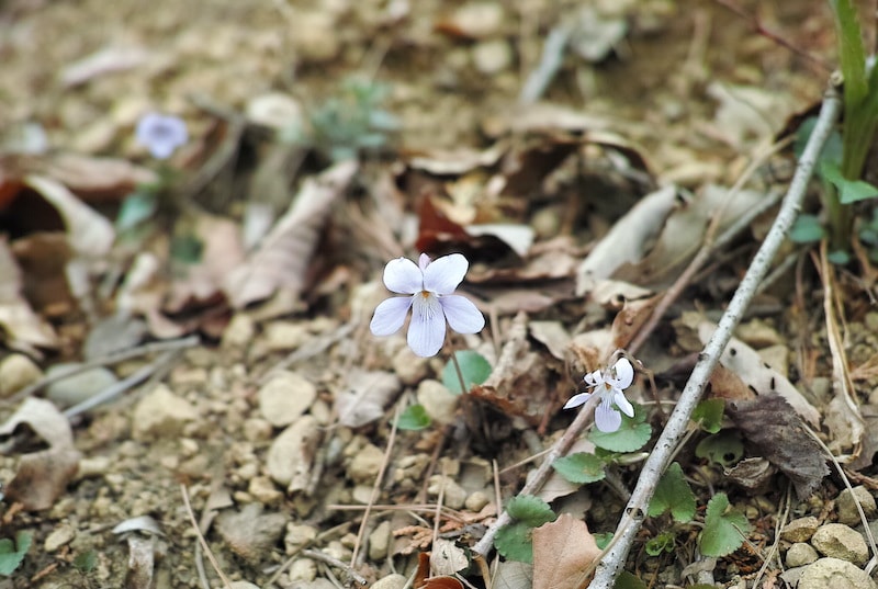
Once we pass the lookout, we come across a sign that says “Nen-zaka” (Nen hill). Is it marking a place of interest on the route, or is it warning us of a challenging section to come? We instinctively brace ourselves for something. But it is actually meant to be written using the Chinese character for Nezumi (mouse) and means “a narrow hill that only a mouse could climb” and is not actually referring to a real place, but is the name of a small village beyond the bottom of the mountain. Glancing down and also notice a beautiful small “Sumire” (Viola mandshurica) flower.
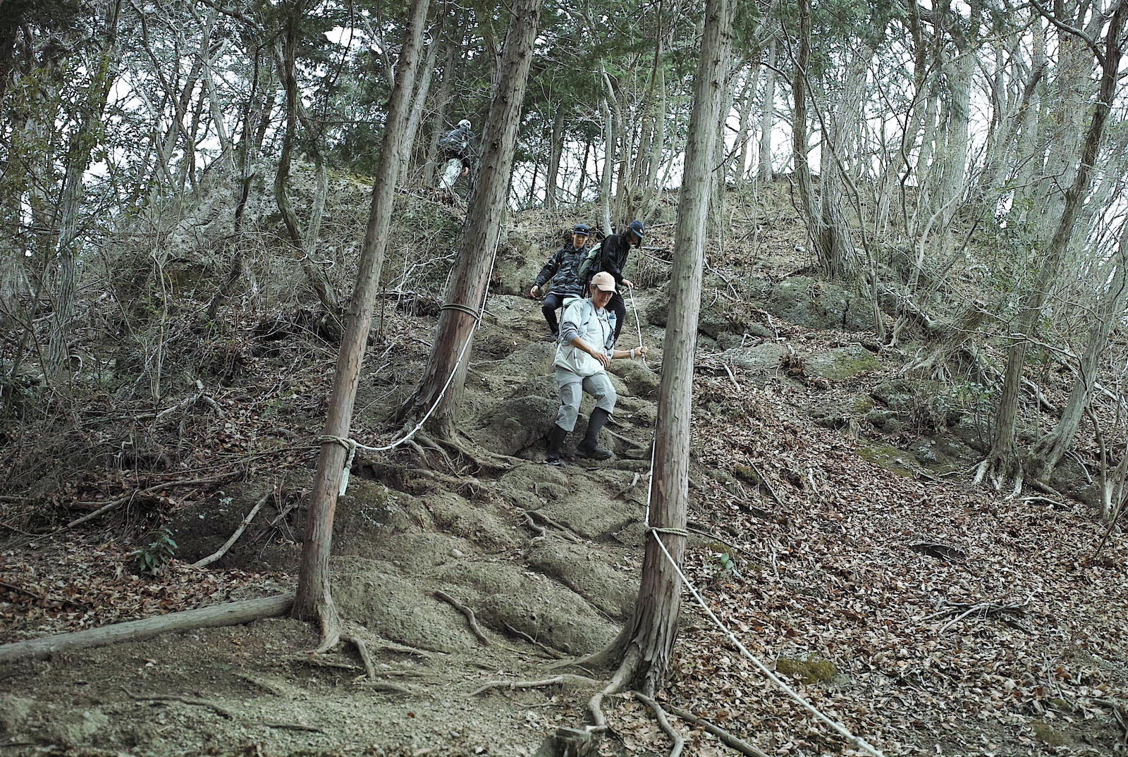
駅の案内所でもらうことができるハイキングマップにも記されているように、この日は「チャレンジコース」を通って下山します。終盤にそれらしい急な岩場が現れましたが、しっかりガイドロープが貼られているので安心です。一足一足、慎重に降りていきます。それにしてもロープという道具は本当に優秀。等間隔で拳大のコブが作られていて、握りやすくて、力を入れる滑り止めにもなります。
As indicated on the hiking map that you can get from the information center at the station, today we are descending via the “Challenge Course”. Towards the end of the route, we come across a suitably “challenging” rocky stretch, but there is a sturdy guide rope for reassurance. We descend cautiously, step by step. Ropes are a truly amazing tool. A fist size knot has been tied into the rope at even intervals making it easy to grip and to hold onto to prevent slipping.
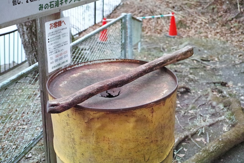
ようやくふもとまで降りてきました。しばし県道517号線を相模湖方面へ歩きます。石老山は初心者に人気の低山とはいえ、なかなかの疲労感。15分ほど行くと、ゆら~りプカプカ。渡し船着き場がある「みの石の入り江(みの石滝キャンプ場)」に到着。そうです。最後はなんと船に乗って湖上を渡るというボーナスステージが待っていたのでした。
システムとしては置かれているドラム缶をたたいて対岸のキャンプ場にいる係の方に知らせるのですが、今回は大所帯だったためか先に係の方が気が付いてしまうという展開(笑)。でも記念にちょっとだけ叩かせていただきました。ガンガンガン! なかなかいい音がします。数名ずつのグループに分かれ、中型の船がある所まで小型のボートでピストンで渡していきます。
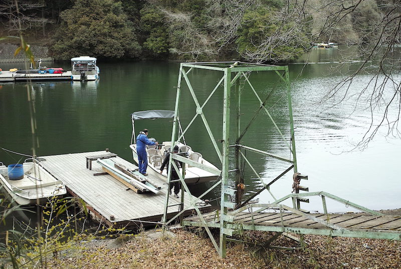
Finally, we have reached the foot of the mountain. We walk along prefectural road 517 for a little while towards lake Sagami. Although Mt. Sekirou is a small mountain, popular amongst beginners, we all feel quite tired. After walking for about 15 minutes, we arrive at “Minoishino Irie” (Minoishi-taki Camp Site) where the landing jetty for the ferry is located. Yes, you guessed it. The final bonus stage of today’s hike is a boat ride across the lake.
You are meant to bang the drum cans to get the attention of the staff member at the campsite on the other side of the crossing, but as we are such a big group, they notice us before we can actually signal them. But we still banged them just a little bit anyway, to commemorate our arrival. Bang, bang! It’s a very satisfying noise. We divide into small groups and take it in turns to be ferried across to the larger boats.
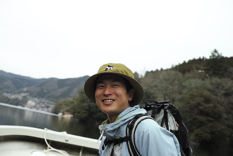
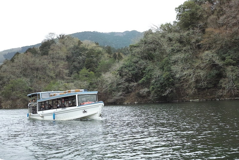
丸に「み」のマークがかわいい遊覧船と中型のボートの2隻に分かれて出港。筆者はボートの方に乗って撮影したのが上の写真です。波はまったくなく、サラサラと湖上の風が気持ちよく頬を伝っていきます。登山なのに船にも乗れるなんて。すごいぞ石老山。
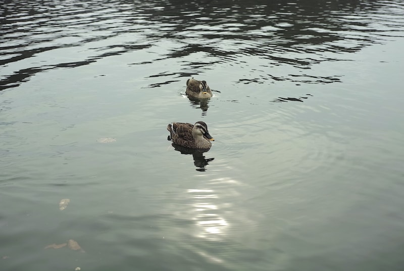
湖上には僕らの他にボートに乗ってバス釣りをしている方が数名いました。ものの数分で最終目的地の「神奈川県立相模湖公園」に着岸するとカルガモが2羽、近寄ってきました。いよいよ旅も終わりです。
We set off in two boats, an excursion boat with a cute “み” (mi) logo, and another medium sized boat. The pictures above are ones that I took from the medium sized boat. There are no waves and the fresh lake air gently brushes our cheeks as we cross the lake. A bonus boat ride to end the hike – Mt. Sekirou is full of surprises!
There are other people on the lake fishing for trout. Very soon we reach our final destination “Lake Sagami Prefectural Park” where we are greeted by two spot-billed ducks. We are now reaching the end of our trip.
たった今登ってきた石老山に見守られながら公園の広場に集合し、スタッフが挨拶をして解散です。わずか1日の行程とは思えないくらい見どころ満載だった石老山でのHIKING CLUB。気が遠くなるほど長い時を重ねた山と湖の関係。平安時代の人々が見た風景や、伝承された物語に余韻を重ねながら、思い思いの帰路へ。みなさんまた遠くないうちにきっと戻ってきそうです。それではまた次回に。
We gather in the park, looked over by Mt. Sekirou that we just climbing. The staff say goodbye to the group before everyone heads their separate ways. Today’s HIKING CLUB was so fun packed, it’s hard to believe that it was just a day trip. Contemplating the eternal relationship between lake and mountain, or imagining the landscapes that the people of the Heian period saw or the stories that have been passed down, we all quietly reflect on the day as we head home. I’m sure everyone will be back again soon. See you next time!
translation Yuko Caroline Omura