

2021.12.14
Report | and wander HIKING CLUB
in Mt. Bonooreand wander journal #36
錦織りなす山々に誘われてand wander HIKING CLUB一行が訪れたのは東京・奥多摩と埼玉・奥武蔵の境にある「棒ノ折(ぼうのおれ・標高969m)」。都心からのアクセスも良く、天気が良ければ、初心者でも楽しめる「沢登り」が人気の山です。
名の由来は、鎌倉時代の武将が山越えの際に、突いていた石棒がこの山で折れてしまったという言い伝えによるもので、棒ノ峰や棒ノ嶺とも呼ばれ、諸説があるようですが、山の名の由来というのは土地々々に残る伝承や神話に触れるようで、奥深しいおもしろさがあります。
Drawn to the beautiful mountain scenery, the “and wander HIKING CLUB” decide to visit Mt. Bonoore (969m altitude), located on the border between Okutama in Tokyo, and Okumusashi in Saitama. Easily accessible from Tokyo, the mountain is also popular for “Sawanobori” (stream climbing), which, weather permitting, can even be enjoyed by beginners.
The name of the mountain has its origins in the Kamakura period when it is said that a military commander’s stone bar (sekibo) broke as he was crossing the mountain. There are various other theories about the mountain’s naming, and it is also known as “Bonomine”. Stories about the origins of mountains’ names are deeply fascinating, each seemingly intertwined with the folklore and myth of the region.
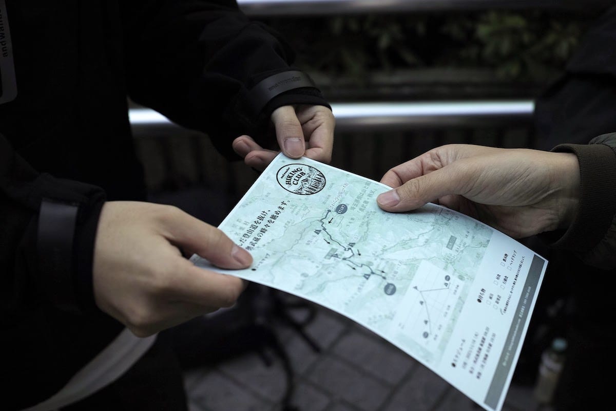
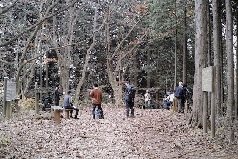
当日の朝の集合場所は、自然豊かな奥武蔵が広がる飯能市の玄関口「西武鉄道・飯能駅」のバスターミナル。人と車の忙しい往来を横目に青い空を見上げると、ところどころに雲があるものの、まずまずの登山日和と言えそうです。徐々に集まり始めた参加者にスタッフが声をかけながら、この日の行程やコースマップが記された登山のしおりを渡していました。バスの出発を待つそわそわした時間に、こういった一日のイメージができる資料があると、幾分気持ちも落ち着きます。
The meeting point on the morning of the hike is the bus terminal at Hanno station on the Seibu Railway. This station serves as the entrance to Hanno city and the rich nature of Okumusashi. Diverting my eyes from the people and cars that are busily coming and going, I look up at the bright blue sky. While there are a few clouds about, it looks like it will be pretty good hiking weather. Staff call out to members of our group as they slowly start to gather, and hand out a mountain guidebook containing the day’s hiking route and map. During the restless wait for the bus, the guidebook serves to help people envisage the day and calm some nerves.
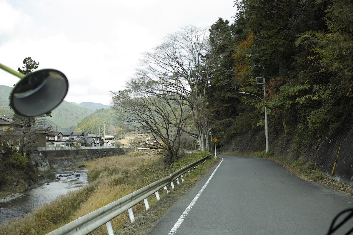
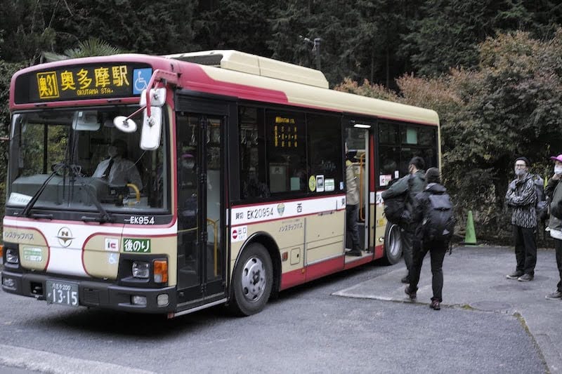
定刻となり、さわやかなライトグリーンの国際興業バスに乗り込みます。平日にも関わらず、車内には多くの登山客が乗り合わせていました。走り出したバスは市街地をすり抜け、曲がりくねった入間川沿いを北上。鮮やかな秋色に染まった山々が近づくにつれ、車一台分くらいの、道が細くなった箇所も現れます。しかしバスは慣れた様子で対向車と譲り合い、気の配り合いをしていました。登山中もこのように気持ちに余裕をもって歩きたいものです。
When it’s time to depart, we all climb onto the light green Kokusai Kogyo bus. Even though it’s a weekday, many mountain climbers join us. The bus drives through the town, and climbs north alongside the banks of the winding Iruma River. As we get closer to the mountains, which have put on a splendid display of vivid autumn colours, we encounter sections of the road that are only just as wide as the bus. The bus, seemingly used to the narrow roads, courteously takes turns, yielding the way to cars coming the other way. This evokes an image of the composed and considerate hiker that we all also aspire to be.
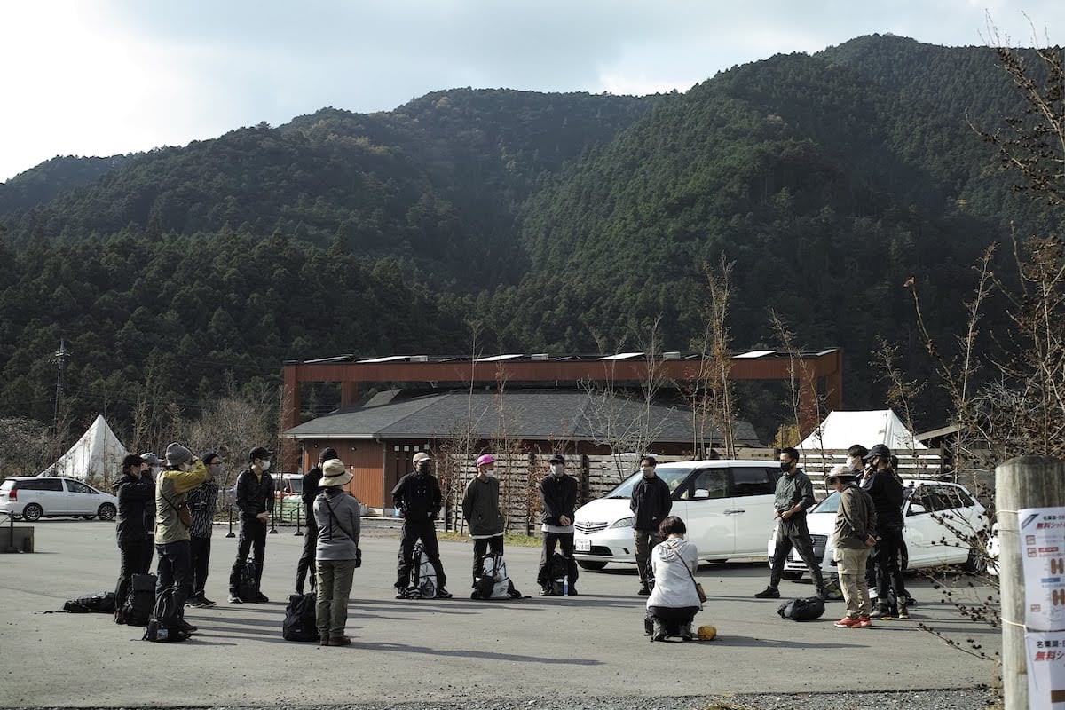
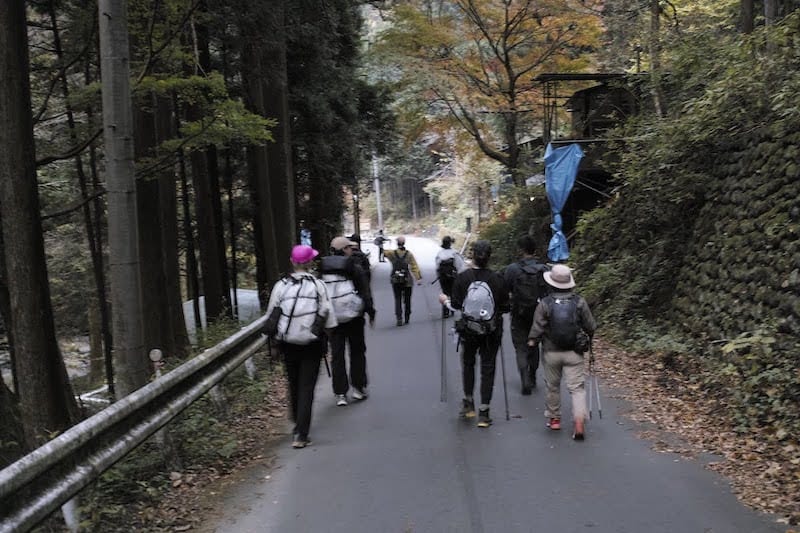
40分ほどで登山口の最寄りとなるバス停「さわらびの湯」へ到着。おいしい空気に胸を膨らませながら、ゆるく輪になって、自己紹介。どっしりと落ち着き払ったベテランと緊張気味の新人スタッフ、何度も参加くださっている方から初参加の方まで、ここからはみんな、顔見知りです。冗談も交わして緊張をほぐし合った次は、身体もほぐしておきましょう。入念にストレッチをして、忘れずにトイレも済ませて出発。緑と赤と黄色。もうすぐ冬を迎える山々の美しいグラデーションに囲まれた「有間ダム」を横目に、登山口へ向かいます。
After about 40 minutes, we arrive at the bus stop closest to the starting point of our hike, “Sawarabi-no-yu”. As we fill our lungs with delicious mountain air, we get into a circle and introduce ourselves. The experienced staff give off an air of calm confidence while the new staff appear slightly nervous. On this day some people are joining us for the first time, while others have been regular participants on our hikes. Now that we’ve all met, and a few jokes have been shared to break the ice, it’s time for some pre-hike stretching. After carefully stretching, and not forgetting to go to the bathroom, we set off. Green, red, yellow - as we walk past Arima Dam, heading towards the entrance to the mountain hiking trail, we are surrounded by the beautiful colour gradation of the late autumn mountains.
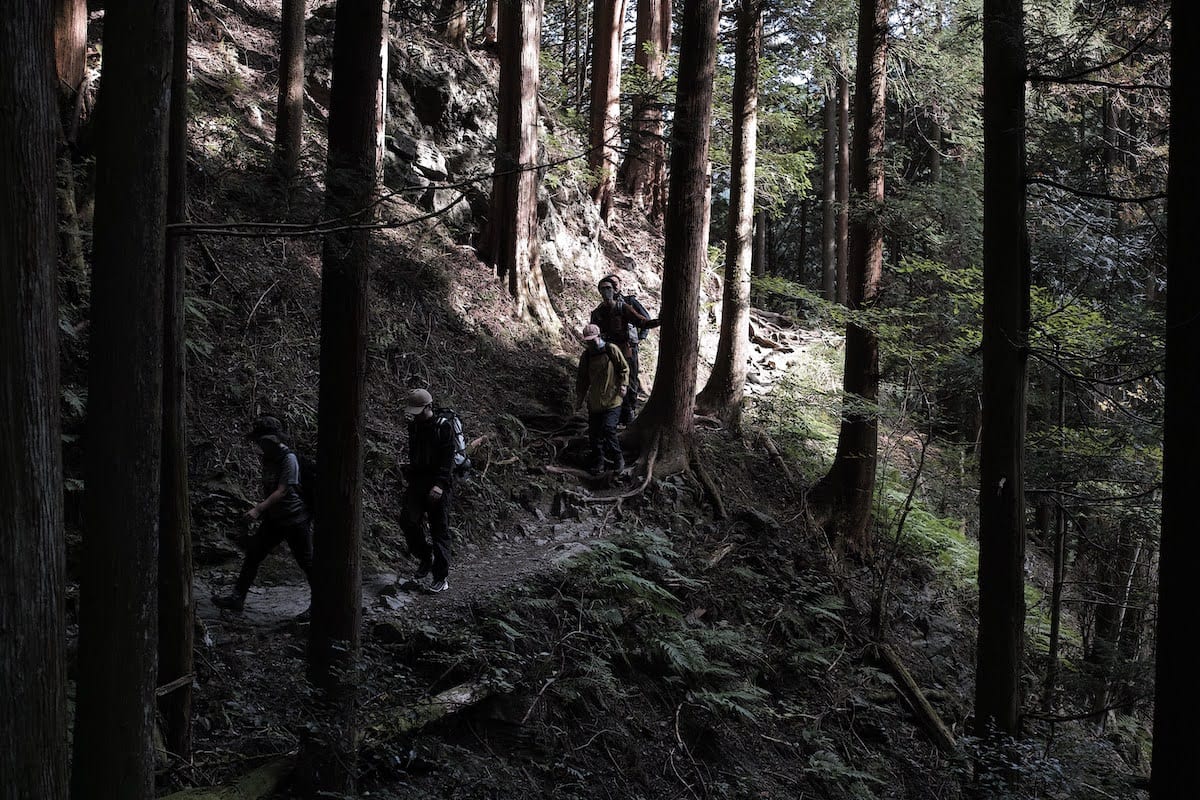
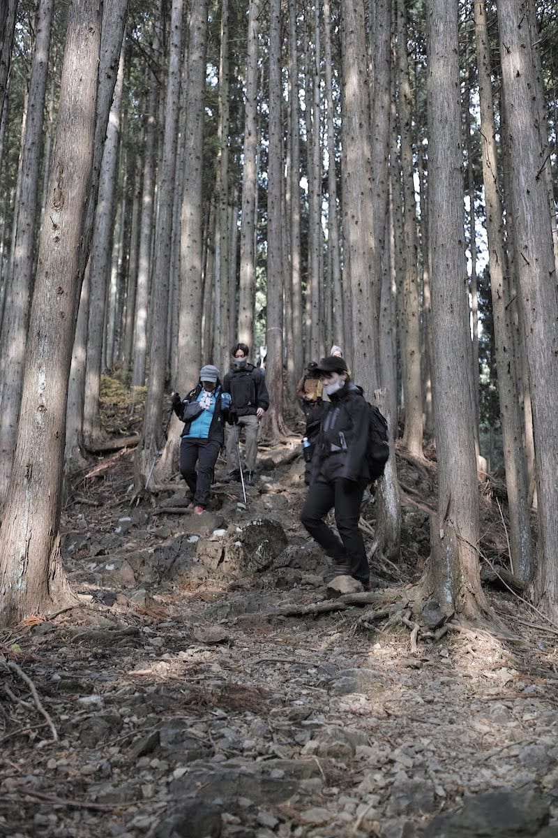
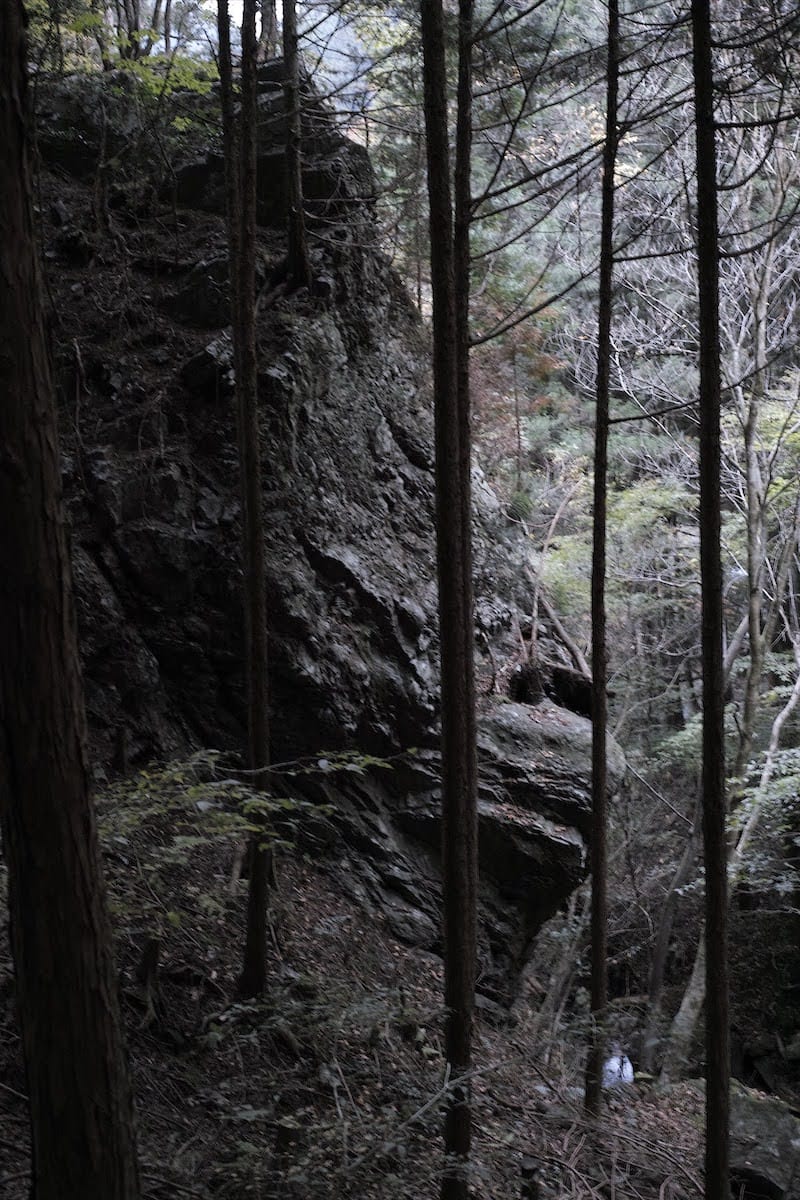
10分ほどで白谷橋登山口につき、ここから入山です。木漏れ日を浴びながら、気持ち良い森林を行きます。やがて沢の音が近づいてくると、苔むした岩が現れ、空気もひんやりしてきました。いよいよこのルートの醍醐味ともいえる白谷沢の沢歩きが始まります。棒ノ折登山の特徴ともいえるこの沢はフランス語で「のど」を意味する「ゴルジュ帯」と呼ばれ、両岸の岸壁が狭まったその細い谷筋は、沢を飛び越えたり、くさりやロープをつかんで岩壁をよじ登ったりと、スリル満点。
After about ten minutes, we arrive at the Shiratanibashi trailhead. Dappled sunlight falls through the trees, making for a very pleasant forest walk. Before long, the sound of a mountain stream draws closer. The air feels cooler and the rocks are coated with moss. From here we are to experience one of the real appeals of Mt. Bonoore, the climb up the Shiratani stream. This stream, a distinguishing feature of hiking at Mt. Bonoore, runs through a gorge, a word that originated from the French word for throat. The hike through the gorge, up the narrow river channel with steep cliffs on either side, is full of thrills as we jump over the stream and grab hold of chains or ropes to pull ourselves up the rocks.
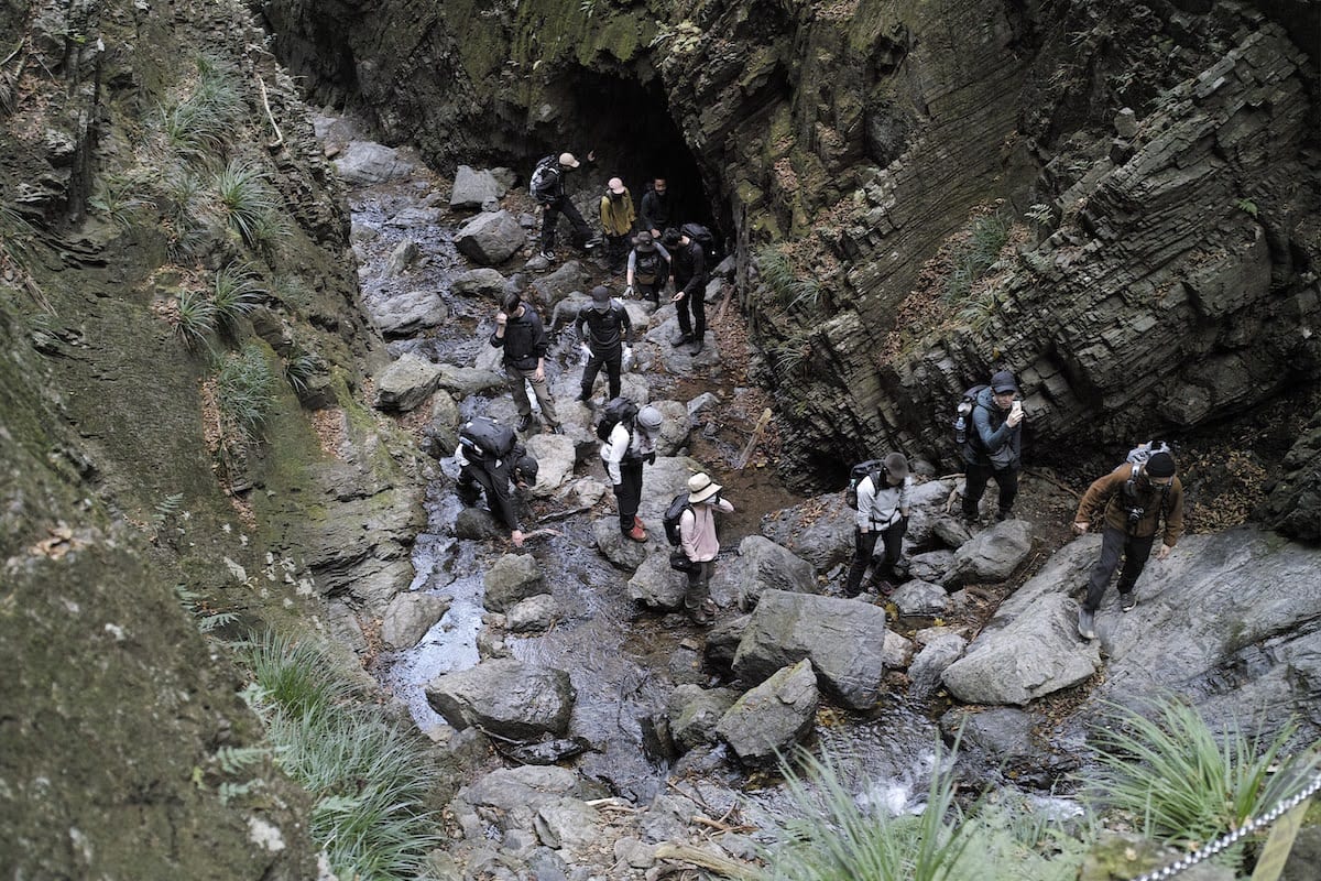
岩場やくさり場などの危ない場所は、両手両足の4点で岩を捉えた状態から、1点だけ動かして身体を移動させていく「三点確保」という基本的な動きを用います。つねに3点は動かさずに安定させることで大きくバランスを崩すリスクが減り、より安全に岩場を上り下りすることができます。また下りの段差が大きいところは腰を下ろし、先へ足を出すと体重移動がしやすいです。
For the more dangerous parts of the climb, such as rocky areas and “via ferrata”, we use the basic “three-point climbing technique” in which you start from a position with both hands and both feet all in contact with the rock. From this position, you move just one limb at a time as you climb. By always having three points in contact with the mountain you can reduce the chance of losing your balance, making a rocky ascent or descent safer. When descending in places with very uneven steps, you can also sit down and put your feet out first, to make it easier to transfer your weight.
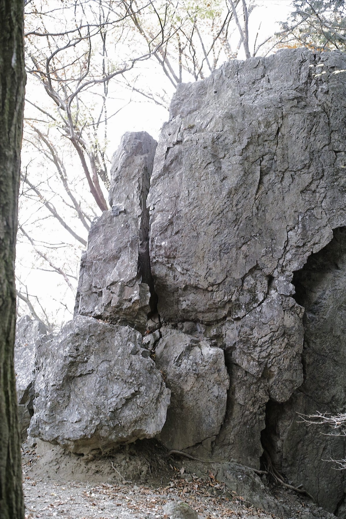
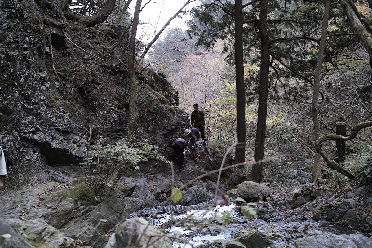
沢登りをたっぷり味わった一行は林道に出たところで一休み。その先の急登を上がると現れる巨岩がこの「岩茸石(いわたけいし)」です。事前に下見をしていたスタッフから「岩の上にあがれますよ」と聞いた勇敢な参加者がさっそく登攀成功。いい写真が撮れるかもと思い、続いて筆者もあがってみたものの、脚がすくんで立っていられませんでした(笑)。それにしても、どうして二階建ての家ほどもある巨岩がこんなところに。不思議です。
After having fully enjoyed the “Sawanobori” our group comes out onto a mountain path, where we take a short break. At the top of a steep slope, beyond the area where we are resting is a giant rock, named “Iwatakeishi”. Some brave participants heard from a staff member who had climbed the route beforehand that “you can climb onto the top of the rock”, and immediately set off to conquer it. Thinking I would be able to get a good photo from the top, I also climb onto it, but having got to the top, my legs freeze and I am unable to stand up! Even so, it’s intriguing to think why a rock as high as a two-story house could be here.
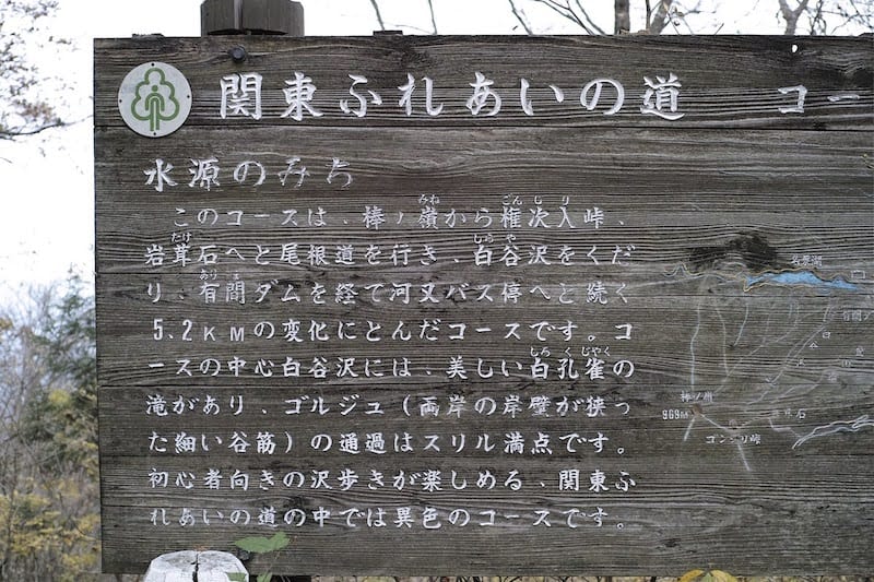
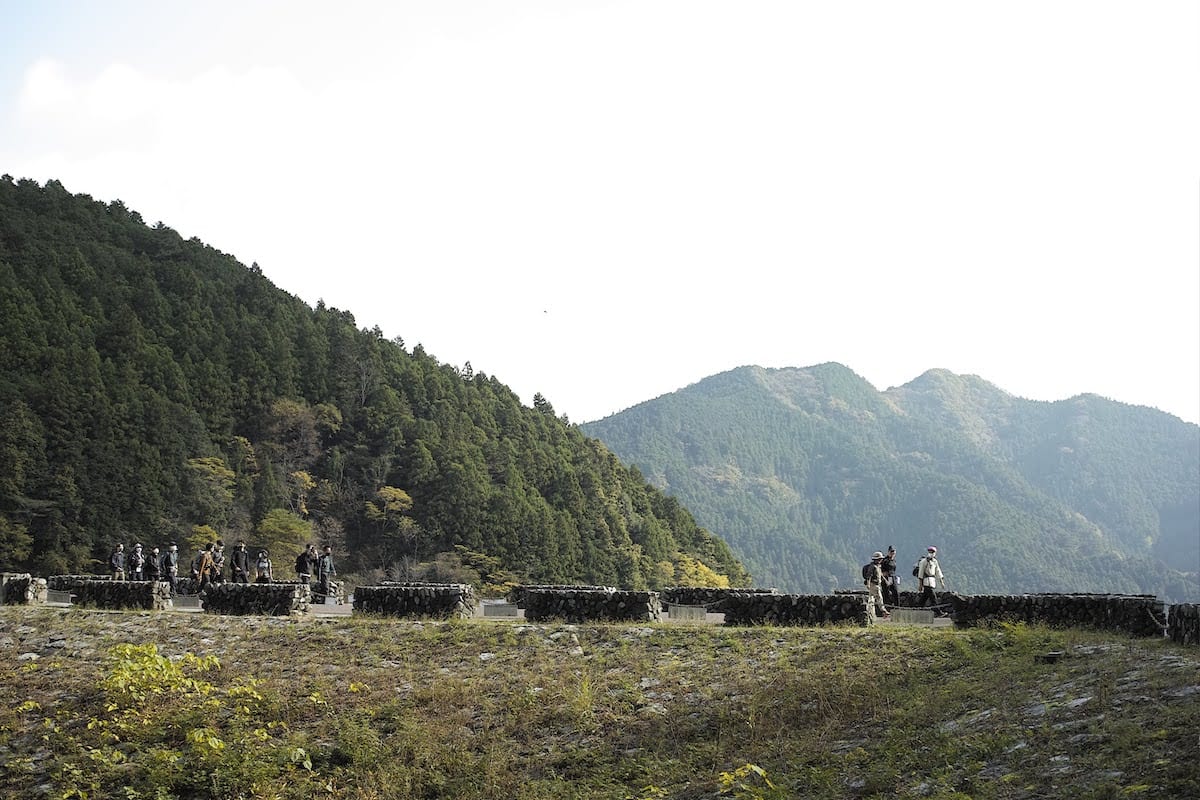
頂上まであとすこし、権次入(ゴンジリ)峠に到着。このルートは「関東ふれあいの道」という、関東地方の一都六県の自然歩道をぐるりと結んだ1799kmにも及ぶロングハイクコースの一部にもなっていました。出発してからここまでで2時間と40分、たっぷりの沢登りと急登で疲れた脚を休ませます。
Once we arrive at the Gonjiri pass, we are close to the top. This hiking route is actually also part of the “Kanto Fureai Trail”, a long hiking course of 1,799 km that circumnavigats the entire Kanto region, passing through Tokyo and the six surrounding prefectures. Two hours and forty minutes into the hike, we take a break to rest our legs, tired from the “Sawanobori” and subsequent steep climb.
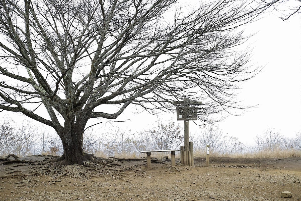
ついに標高969mの山頂です。到着直後は霧がかかっていましたが、ランチタイムを楽しみながら、絶景と評判の眺望を気長に待つことに。標識の横にひときわ強い存在感を放って立つ立派な桜の木。春の満開時にはさぞ見事な姿で登山者を迎えてくれるのでしょう。
Finally, we reach the top of the mountain at an elevation of 969m. The peak is crowned with fog when we arrive, so we decide to have lunch while we wait for a glimpse of the famously impressive view. A splendid cherry tree stands next to the sign marking the peak, making quite an impression. When the cherry blossom is in full bloom in the Spring, it must greet climbers with a spectacular display.
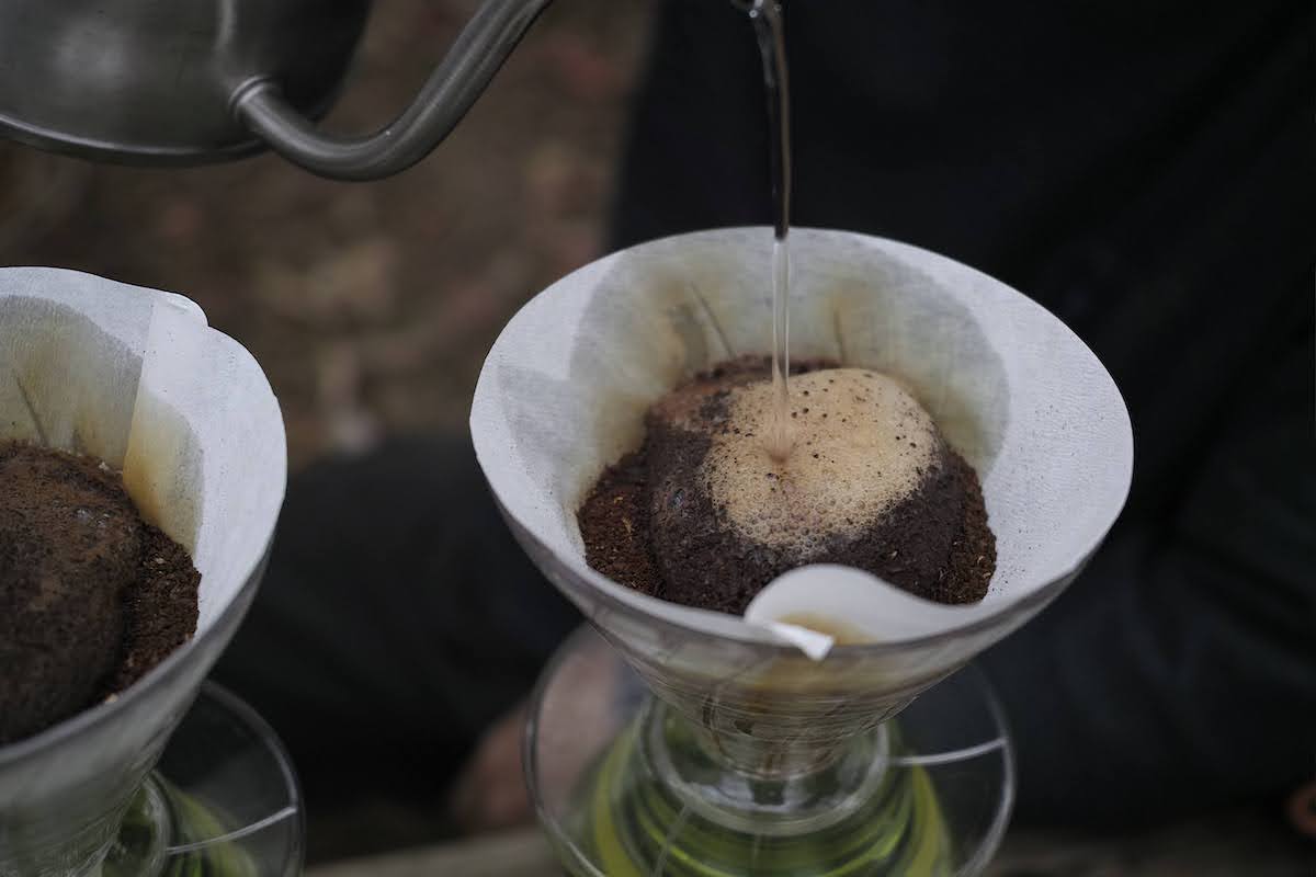
ハイキングクラブのランチタイムと言えば、and wanderから恒例のドリップコーヒーサービス。今回も東京・西原にあるPADDLERS COFFEEより、STUMPTOWN COFFEE ROASTERSのEVERGREENという豆を持ってきました。スタッフが3人がかりで手早く挽き、お湯を注ぐといい感じにプクプク膨らみます。漂う香りがたまりません。
You can’t have lunch with the Hiking Club without the customary “and wander” complementary coffee. This time is no different. Staff have brought some Stumptown Coffee “Evergreen” beans from Paddlers Coffee in Nishihara, Tokyo. Three staff members swiftly grind the beans, which gently expand as the hot water is poured over them, giving off the most enticing aroma.
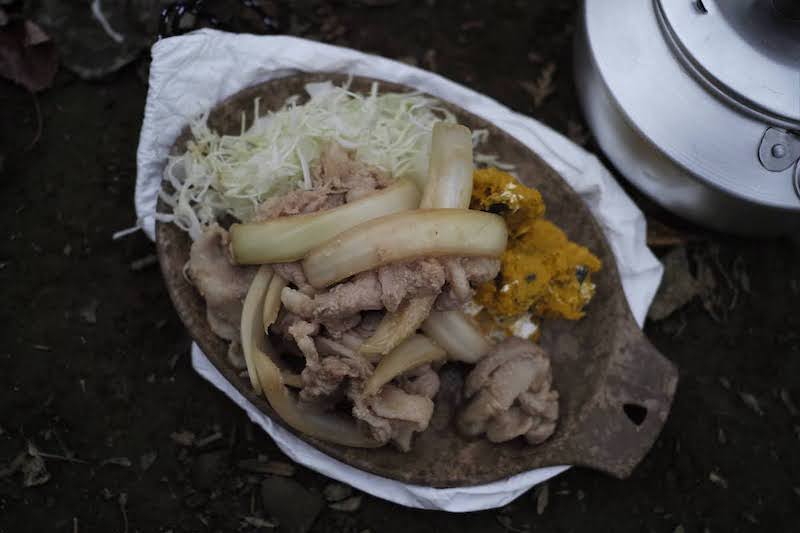
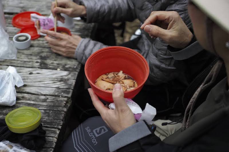
前夜に仕込んできたという生姜焼き定食を作る強者スタッフがいたり、最中をお湯で戻してお汁粉にして味わっている参加者の方がいたりと、各々が工夫を凝らしたランチタイムは見ているだけでもおもしろいです。こうして何か「楽しみ」を持って登るというのもいいですね。「頂上にいけばアレが待っている・・・」と思えば、疲れた時のモチベーションになってくれそうです。
One courageous staff member makes a ginger pork lunch set, which they had prepped the night before, while a
participant pours hot water over a Monaka*1 to make Oshiruko*2 . It’s fun just to watch
each
person’s elaborate
lunch taking shape. It’s great to bring something to look forward to when you go hiking. When you get tired,
remembering that a “treat is waiting for me once I get to the top...” can help motivate you.
*1 A Japanese sweet made of azuki bean paste sandwiched between two thin
crisp
wafers made from
mochi.
*2 A traditional Japanese dessert of sweet porridge of azuki beans and mochi.
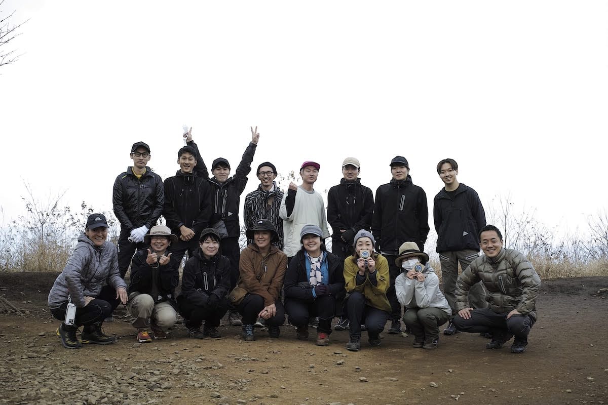
お腹も満たされたころ、幸運にも霧が晴れ、眺望が開けてきました。はるか先まで見渡せるほどではありませんでしたが、それでも十分、関東平野の壮大な景色を味わうことができました。記念写真を撮って下山開始です。
Luckily, the mist clears so with our bellies full, we are able to enjoy the view. Although we can’t see far out into the distance, the fog clears enough for us to be able to look out and enjoy the expansive view of the Kanto Plain. After taking a group photo, we begin the descent.
西に傾き始めたお日様からの木漏れ日を受けて「森林浴」という言葉がぴったりな斜面を下っていきます。斜度がきついところは不安定な浮石を踏まないように気を付けつつ、ひたすら樹に囲まれた不思議な時間。ちょっと木こりになった気分です。やがて再び沢の気配が近づいてきて、先を歩く方々がどこか一方をしきりに指さすので、なんだろうと視線を向けると大きな顔のような岩壁が!
As the sun moves round to the west, the dappled sunlight falls through the trees, making for the perfect “forest-bathing” walk down the mountain. On the steeper areas, we take care not to step on loose rocks. Being completely surrounded by trees the whole time somehow feels mystical. I almost start to feel like a lumberjack. Nearing a mountain stream again, people at the front of our group all start pointing in the same direction, so I look, too, wondering what could be there, to see a huge face in the rock!
時刻は15時40分。長かった道のりもついにゴールです。今回のコースでは埼玉側の奥武蔵から登り始めて、東京側の奥多摩に下りてきました。バス停までのダウンウォークは、心地よい疲労感と充実感がないまぜになった、ご褒美のようなしあわせな時間。朱色と黄色の色をした可愛らしい西東京バスに乗って、JR青梅線・川井駅へ向かいます。あたたかい車内の座席に腰を降ろしたとたん、ものすごい睡魔が。
At forty minutes past three we reach the end of our long hike. For this trip we started climbing from Okumusashi in Saitama prefecture, and came out in Okutama on the Tokyo side. It’s a downhill walk to the bus stop, and gentle exhaustion and a sense of fulfillment blend together to reward us with that blissful, post-hike, feeling of contentment. We get on the cute orange and yellow Nishi-Tokyo bus and head towards Kawai Station on the JR Ome line. The moment we sit down in the warm bus, we’re overwhelmed by sleepiness.
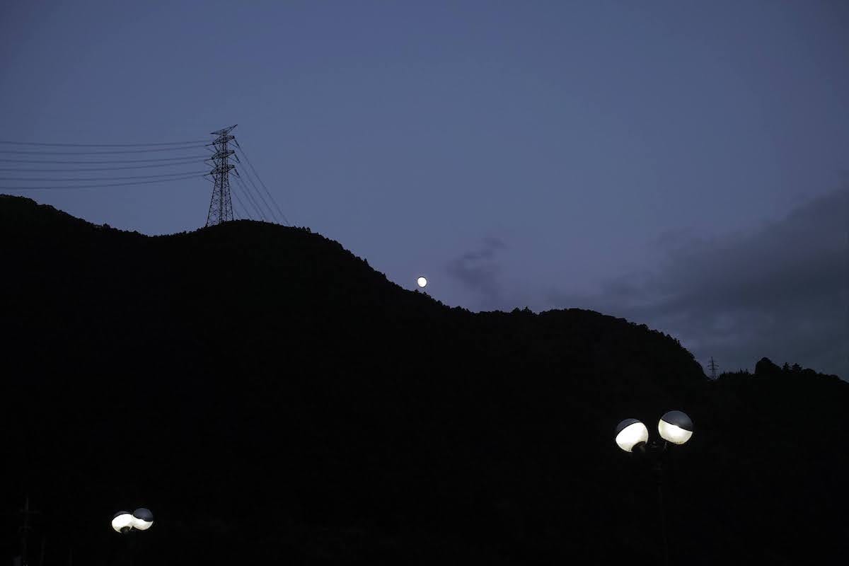
川井駅着。これにて全行程終了。上り電車が来るまで、各々余韻に浸ります。陽が落ちた山の稜線からは丸い月が登ってきました。山から下りてきた私たちと、山から登った丸い月。登りと下りはまるでひとつのサイクルのようです。楽しかった「棒ノ折」の思い出をお土産に、今夜はゆっくり休んで、また明日から頑張りましょう。また次回に。
Kawai station marks the end of today’s excursion. We all enjoy the lingering sensations from the hike as we wait for our train to arrive. The moon rises from behind the now dark mountain ridgeline. As we came down from the mountain, the round moon rose up. Ascending and descending, it seems to all be one cycle. Rest well tonight and enjoy the happy memories we take home from Bonoore, as we get ready for another day tomorrow. See you next time!
translation Yuko Caroline Omura